You are here: Home > Network List > TA - USArray Transportable Network (new EarthScope stations) Stations List
> Station H16K Elim, AK, USA > Earthquake Result Viewer
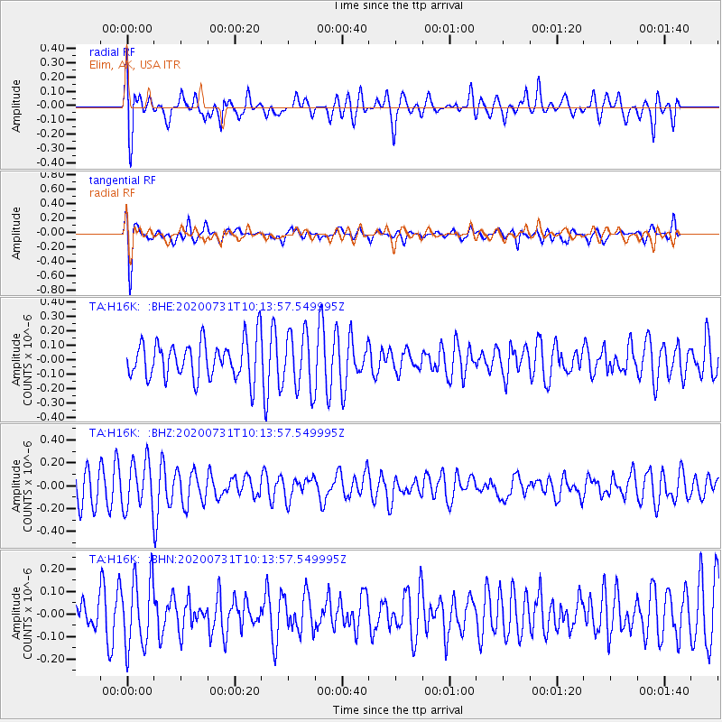
H16K Elim, AK, USA - Earthquake Result Viewer
*The percent match for this event was below the threshold and hence no stack was calculated.
| Earthquake location: |
D'Entrecasteaux Islands Region |
| Earthquake latitude/longitude: |
-8.7/152.7 |
| Earthquake time(UTC): |
2020/07/31 (213) 10:02:16 GMT |
| Earthquake Depth: |
10 km |
| Earthquake Magnitude: |
5.6 Mww |
| Earthquake Catalog/Contributor: |
NEIC PDE/us |
|
| Network: |
TA USArray Transportable Network (new EarthScope stations) |
| Station: |
H16K Elim, AK, USA |
| Lat/Lon: |
64.64 N/162.24 W |
| Elevation: |
216 m |
|
| Distance: |
80.5 deg |
| Az: |
17.999 deg |
| Baz: |
225.175 deg |
| Ray Param: |
$rayparam |
*The percent match for this event was below the threshold and hence was not used in the summary stack. |
|
| Radial Match: |
70.895355 % |
| Radial Bump: |
400 |
| Transverse Match: |
67.25974 % |
| Transverse Bump: |
400 |
| SOD ConfigId: |
21709731 |
| Insert Time: |
2020-08-14 10:13:45.377 +0000 |
| GWidth: |
2.5 |
| Max Bumps: |
400 |
| Tol: |
0.001 |
|
Signal To Noise
| Channel | StoN | STA | LTA |
| TA:H16K: :BHZ:20200731T10:13:57.549995Z | 1.8177451 | 2.0638656E-7 | 1.13539876E-7 |
| TA:H16K: :BHN:20200731T10:13:57.549995Z | 1.7154974 | 1.5450983E-7 | 9.0067076E-8 |
| TA:H16K: :BHE:20200731T10:13:57.549995Z | 1.5299938 | 1.9859131E-7 | 1.2979876E-7 |
| Arrivals |
| Ps | |
| PpPs | |
| PsPs/PpSs | |


