You are here: Home > Network List > AV - Alaska Volcano Observatory Stations List
> Station AMKA Regional Station, Amchitka Island, Alaska > Earthquake Result Viewer
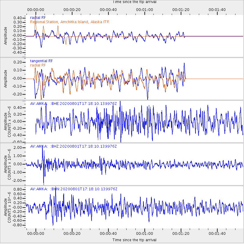
AMKA Regional Station, Amchitka Island, Alaska - Earthquake Result Viewer
*The percent match for this event was below the threshold and hence no stack was calculated.
| Earthquake location: |
Mindanao, Philippines |
| Earthquake latitude/longitude: |
7.3/124.1 |
| Earthquake time(UTC): |
2020/08/01 (214) 17:09:01 GMT |
| Earthquake Depth: |
480 km |
| Earthquake Magnitude: |
6.4 mww |
| Earthquake Catalog/Contributor: |
NEIC PDE/us |
|
| Network: |
AV Alaska Volcano Observatory |
| Station: |
AMKA Regional Station, Amchitka Island, Alaska |
| Lat/Lon: |
51.38 N/179.30 E |
| Elevation: |
116 m |
|
| Distance: |
63.0 deg |
| Az: |
35.253 deg |
| Baz: |
246.003 deg |
| Ray Param: |
$rayparam |
*The percent match for this event was below the threshold and hence was not used in the summary stack. |
|
| Radial Match: |
51.13449 % |
| Radial Bump: |
400 |
| Transverse Match: |
56.044468 % |
| Transverse Bump: |
400 |
| SOD ConfigId: |
21709731 |
| Insert Time: |
2020-08-15 17:13:48.315 +0000 |
| GWidth: |
2.5 |
| Max Bumps: |
400 |
| Tol: |
0.001 |
|
Signal To Noise
| Channel | StoN | STA | LTA |
| AV:AMKA: :BHZ:20200801T17:18:10.139976Z | 3.3947628 | 6.890282E-7 | 2.02968E-7 |
| AV:AMKA: :BHN:20200801T17:18:10.139976Z | 0.98258007 | 1.3010424E-7 | 1.3241083E-7 |
| AV:AMKA: :BHE:20200801T17:18:10.139976Z | 1.0740811 | 1.8625524E-7 | 1.7340892E-7 |
| Arrivals |
| Ps | |
| PpPs | |
| PsPs/PpSs | |


