You are here: Home > Network List > AV - Alaska Volcano Observatory Stations List
> Station KARR Katmai Rainbow River, Alaska > Earthquake Result Viewer
KARR Katmai Rainbow River, Alaska - Earthquake Result Viewer

| Earthquake location: |
Bismarck Sea |
| Earthquake latitude/longitude: |
-3.2/148.6 |
| Earthquake time(UTC): |
2020/08/01 (214) 19:22:06 GMT |
| Earthquake Depth: |
10 km |
| Earthquake Magnitude: |
5.7 Mww |
| Earthquake Catalog/Contributor: |
NEIC PDE/us |
|
| Network: |
AV Alaska Volcano Observatory |
| Station: |
KARR Katmai Rainbow River, Alaska |
| Lat/Lon: |
58.50 N/154.71 W |
| Elevation: |
610 m |
|
| Distance: |
76.1 deg |
| Az: |
26.872 deg |
| Baz: |
239.254 deg |
| Ray Param: |
0.051237214 |
| Estimated Moho Depth: |
36.0 km |
| Estimated Crust Vp/Vs: |
1.60 |
| Assumed Crust Vp: |
6.438 km/s |
| Estimated Crust Vs: |
4.024 km/s |
| Estimated Crust Poisson's Ratio: |
0.18 |
|
| Radial Match: |
81.45503 % |
| Radial Bump: |
400 |
| Transverse Match: |
76.79135 % |
| Transverse Bump: |
400 |
| SOD ConfigId: |
21709731 |
| Insert Time: |
2020-08-15 19:25:48.788 +0000 |
| GWidth: |
2.5 |
| Max Bumps: |
400 |
| Tol: |
0.001 |
|
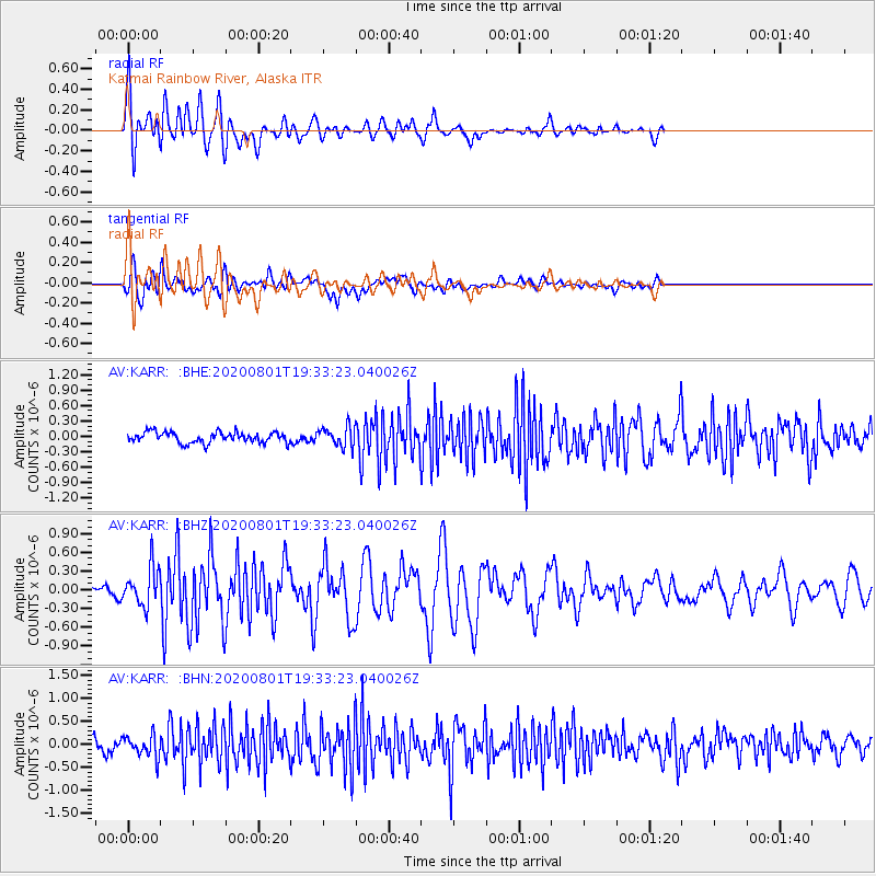
Signal To Noise
| Channel | StoN | STA | LTA |
| AV:KARR: :BHZ:20200801T19:33:23.040026Z | 5.1266 | 3.094513E-7 | 6.0361906E-8 |
| AV:KARR: :BHN:20200801T19:33:23.040026Z | 2.3651848 | 2.41062E-7 | 1.01921E-7 |
| AV:KARR: :BHE:20200801T19:33:23.040026Z | 1.8647594 | 1.9358079E-7 | 1.0381006E-7 |
| Arrivals |
| Ps | 3.5 SECOND |
| PpPs | 14 SECOND |
| PsPs/PpSs | 18 SECOND |


