You are here: Home > Network List > CN - Canadian National Seismograph Network Stations List
> Station INK INUVIK, NT > Earthquake Result Viewer
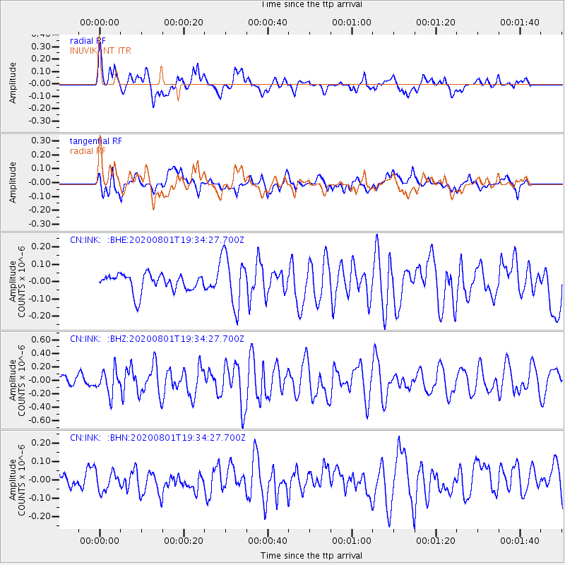
INK INUVIK, NT - Earthquake Result Viewer
*The percent match for this event was below the threshold and hence no stack was calculated.
| Earthquake location: |
Bismarck Sea |
| Earthquake latitude/longitude: |
-3.2/148.6 |
| Earthquake time(UTC): |
2020/08/01 (214) 19:22:06 GMT |
| Earthquake Depth: |
10 km |
| Earthquake Magnitude: |
5.7 Mww |
| Earthquake Catalog/Contributor: |
NEIC PDE/us |
|
| Network: |
CN Canadian National Seismograph Network |
| Station: |
INK INUVIK, NT |
| Lat/Lon: |
68.31 N/133.53 W |
| Elevation: |
44 m |
|
| Distance: |
88.5 deg |
| Az: |
21.321 deg |
| Baz: |
257.53 deg |
| Ray Param: |
$rayparam |
*The percent match for this event was below the threshold and hence was not used in the summary stack. |
|
| Radial Match: |
62.52514 % |
| Radial Bump: |
400 |
| Transverse Match: |
71.855034 % |
| Transverse Bump: |
400 |
| SOD ConfigId: |
21709731 |
| Insert Time: |
2020-08-15 19:29:17.221 +0000 |
| GWidth: |
2.5 |
| Max Bumps: |
400 |
| Tol: |
0.001 |
|
Signal To Noise
| Channel | StoN | STA | LTA |
| CN:INK: :BHZ:20200801T19:34:27.700Z | 2.452181 | 1.7992994E-7 | 7.3375475E-8 |
| CN:INK: :BHN:20200801T19:34:27.700Z | 0.85405535 | 5.260773E-8 | 6.159757E-8 |
| CN:INK: :BHE:20200801T19:34:27.700Z | 2.9877822 | 1.5075175E-7 | 5.045607E-8 |
| Arrivals |
| Ps | |
| PpPs | |
| PsPs/PpSs | |


