You are here: Home > Network List > TA - USArray Transportable Network (new EarthScope stations) Stations List
> Station G21K Allakaket, AK, USA > Earthquake Result Viewer
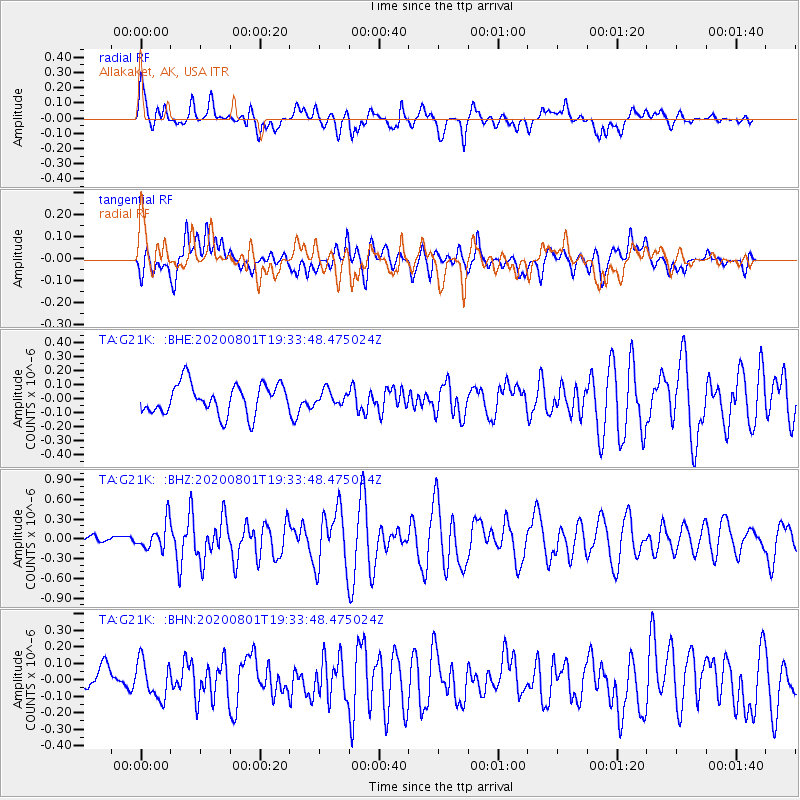
G21K Allakaket, AK, USA - Earthquake Result Viewer
*The percent match for this event was below the threshold and hence no stack was calculated.
| Earthquake location: |
Bismarck Sea |
| Earthquake latitude/longitude: |
-3.2/148.6 |
| Earthquake time(UTC): |
2020/08/01 (214) 19:22:06 GMT |
| Earthquake Depth: |
10 km |
| Earthquake Magnitude: |
5.7 Mww |
| Earthquake Catalog/Contributor: |
NEIC PDE/us |
|
| Network: |
TA USArray Transportable Network (new EarthScope stations) |
| Station: |
G21K Allakaket, AK, USA |
| Lat/Lon: |
66.52 N/153.51 W |
| Elevation: |
446 m |
|
| Distance: |
80.7 deg |
| Az: |
20.114 deg |
| Baz: |
238.957 deg |
| Ray Param: |
$rayparam |
*The percent match for this event was below the threshold and hence was not used in the summary stack. |
|
| Radial Match: |
75.3297 % |
| Radial Bump: |
400 |
| Transverse Match: |
70.998146 % |
| Transverse Bump: |
400 |
| SOD ConfigId: |
21709731 |
| Insert Time: |
2020-08-15 19:34:10.586 +0000 |
| GWidth: |
2.5 |
| Max Bumps: |
400 |
| Tol: |
0.001 |
|
Signal To Noise
| Channel | StoN | STA | LTA |
| TA:G21K: :BHZ:20200801T19:33:48.475024Z | 3.2549255 | 2.0674453E-7 | 6.351744E-8 |
| TA:G21K: :BHN:20200801T19:33:48.475024Z | 1.4341149 | 1.1342951E-7 | 7.909374E-8 |
| TA:G21K: :BHE:20200801T19:33:48.475024Z | 0.46041945 | 4.9606598E-8 | 1.0774219E-7 |
| Arrivals |
| Ps | |
| PpPs | |
| PsPs/PpSs | |


