You are here: Home > Network List > CI - Caltech Regional Seismic Network Stations List
> Station DAN Danby, California, USA > Earthquake Result Viewer
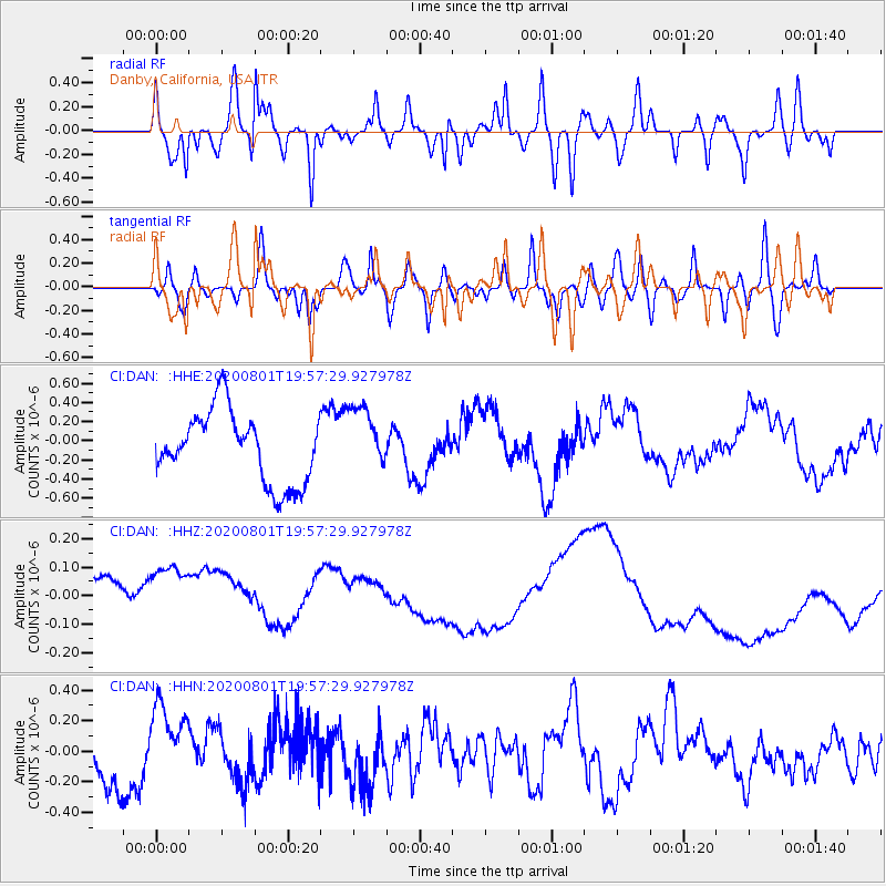
DAN Danby, California, USA - Earthquake Result Viewer
*The percent match for this event was below the threshold and hence no stack was calculated.
| Earthquake location: |
Tonga Islands Region |
| Earthquake latitude/longitude: |
-23.1/-175.8 |
| Earthquake time(UTC): |
2020/08/01 (214) 19:45:45 GMT |
| Earthquake Depth: |
10 km |
| Earthquake Magnitude: |
5.6 Mww |
| Earthquake Catalog/Contributor: |
NEIC PDE/us |
|
| Network: |
CI Caltech Regional Seismic Network |
| Station: |
DAN Danby, California, USA |
| Lat/Lon: |
34.64 N/115.38 W |
| Elevation: |
398 m |
|
| Distance: |
81.1 deg |
| Az: |
46.543 deg |
| Baz: |
234.175 deg |
| Ray Param: |
$rayparam |
*The percent match for this event was below the threshold and hence was not used in the summary stack. |
|
| Radial Match: |
82.68554 % |
| Radial Bump: |
400 |
| Transverse Match: |
71.206375 % |
| Transverse Bump: |
400 |
| SOD ConfigId: |
21709731 |
| Insert Time: |
2020-08-15 19:51:07.855 +0000 |
| GWidth: |
2.5 |
| Max Bumps: |
400 |
| Tol: |
0.001 |
|
Signal To Noise
| Channel | StoN | STA | LTA |
| CI:DAN: :HHZ:20200801T19:57:29.927978Z | 1.0003598 | 2.975949E-7 | 2.9748787E-7 |
| CI:DAN: :HHN:20200801T19:57:29.927978Z | 1.3660026 | 2.464601E-7 | 1.8042434E-7 |
| CI:DAN: :HHE:20200801T19:57:29.927978Z | 0.9272601 | 3.4496694E-7 | 3.7202824E-7 |
| Arrivals |
| Ps | |
| PpPs | |
| PsPs/PpSs | |


