You are here: Home > Network List > TA - USArray Transportable Network (new EarthScope stations) Stations List
> Station I30M Mount Dempster, Yukon, CAN > Earthquake Result Viewer
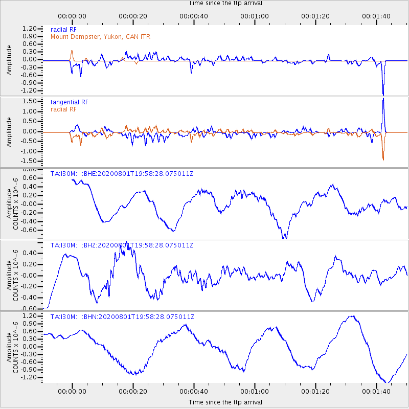
I30M Mount Dempster, Yukon, CAN - Earthquake Result Viewer
*The percent match for this event was below the threshold and hence no stack was calculated.
| Earthquake location: |
Tonga Islands Region |
| Earthquake latitude/longitude: |
-23.1/-175.8 |
| Earthquake time(UTC): |
2020/08/01 (214) 19:45:45 GMT |
| Earthquake Depth: |
10 km |
| Earthquake Magnitude: |
5.6 Mww |
| Earthquake Catalog/Contributor: |
NEIC PDE/us |
|
| Network: |
TA USArray Transportable Network (new EarthScope stations) |
| Station: |
I30M Mount Dempster, Yukon, CAN |
| Lat/Lon: |
65.22 N/136.38 W |
| Elevation: |
1399 m |
|
| Distance: |
93.1 deg |
| Az: |
15.551 deg |
| Baz: |
215.869 deg |
| Ray Param: |
$rayparam |
*The percent match for this event was below the threshold and hence was not used in the summary stack. |
|
| Radial Match: |
59.106895 % |
| Radial Bump: |
400 |
| Transverse Match: |
48.63616 % |
| Transverse Bump: |
400 |
| SOD ConfigId: |
21709731 |
| Insert Time: |
2020-08-15 19:58:43.525 +0000 |
| GWidth: |
2.5 |
| Max Bumps: |
400 |
| Tol: |
0.001 |
|
Signal To Noise
| Channel | StoN | STA | LTA |
| TA:I30M: :BHZ:20200801T19:58:28.075011Z | 0.6328894 | 3.0711453E-7 | 4.8525783E-7 |
| TA:I30M: :BHN:20200801T19:58:28.075011Z | 1.7482266 | 7.3920177E-7 | 4.2282952E-7 |
| TA:I30M: :BHE:20200801T19:58:28.075011Z | 1.9011586 | 5.920639E-7 | 3.114227E-7 |
| Arrivals |
| Ps | |
| PpPs | |
| PsPs/PpSs | |


