You are here: Home > Network List > US - United States National Seismic Network Stations List
> Station AMTX Amarillo, Texas, USA > Earthquake Result Viewer
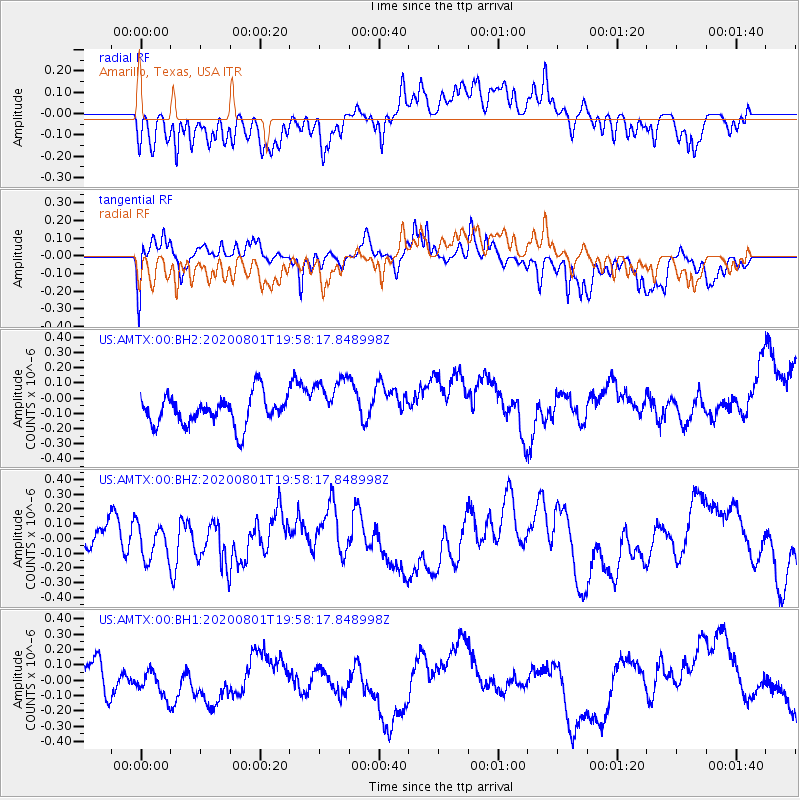
AMTX Amarillo, Texas, USA - Earthquake Result Viewer
*The percent match for this event was below the threshold and hence no stack was calculated.
| Earthquake location: |
Tonga Islands Region |
| Earthquake latitude/longitude: |
-23.1/-175.8 |
| Earthquake time(UTC): |
2020/08/01 (214) 19:45:45 GMT |
| Earthquake Depth: |
10 km |
| Earthquake Magnitude: |
5.6 Mww |
| Earthquake Catalog/Contributor: |
NEIC PDE/us |
|
| Network: |
US United States National Seismic Network |
| Station: |
AMTX Amarillo, Texas, USA |
| Lat/Lon: |
34.53 N/101.41 W |
| Elevation: |
1010 m |
|
| Distance: |
90.9 deg |
| Az: |
52.685 deg |
| Baz: |
242.527 deg |
| Ray Param: |
$rayparam |
*The percent match for this event was below the threshold and hence was not used in the summary stack. |
|
| Radial Match: |
54.79443 % |
| Radial Bump: |
400 |
| Transverse Match: |
58.93287 % |
| Transverse Bump: |
400 |
| SOD ConfigId: |
21709731 |
| Insert Time: |
2020-08-15 20:00:52.161 +0000 |
| GWidth: |
2.5 |
| Max Bumps: |
400 |
| Tol: |
0.001 |
|
Signal To Noise
| Channel | StoN | STA | LTA |
| US:AMTX:00:BHZ:20200801T19:58:17.848998Z | 1.087121 | 1.1688226E-7 | 1.07515405E-7 |
| US:AMTX:00:BH1:20200801T19:58:17.848998Z | 0.51409894 | 7.860277E-8 | 1.5289423E-7 |
| US:AMTX:00:BH2:20200801T19:58:17.848998Z | 1.740615 | 1.7309307E-7 | 9.944363E-8 |
| Arrivals |
| Ps | |
| PpPs | |
| PsPs/PpSs | |


