You are here: Home > Network List > UW - Pacific Northwest Regional Seismic Network Stations List
> Station FISH Seaside, OR, USA > Earthquake Result Viewer
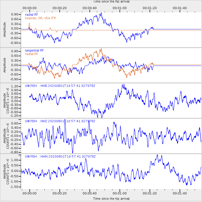
FISH Seaside, OR, USA - Earthquake Result Viewer
*The percent match for this event was below the threshold and hence no stack was calculated.
| Earthquake location: |
Tonga Islands Region |
| Earthquake latitude/longitude: |
-23.1/-175.8 |
| Earthquake time(UTC): |
2020/08/01 (214) 19:45:45 GMT |
| Earthquake Depth: |
10 km |
| Earthquake Magnitude: |
5.6 Mww |
| Earthquake Catalog/Contributor: |
NEIC PDE/us |
|
| Network: |
UW Pacific Northwest Regional Seismic Network |
| Station: |
FISH Seaside, OR, USA |
| Lat/Lon: |
45.93 N/123.56 W |
| Elevation: |
325 m |
|
| Distance: |
83.4 deg |
| Az: |
33.75 deg |
| Baz: |
227.15 deg |
| Ray Param: |
$rayparam |
*The percent match for this event was below the threshold and hence was not used in the summary stack. |
|
| Radial Match: |
74.76695 % |
| Radial Bump: |
400 |
| Transverse Match: |
39.52854 % |
| Transverse Bump: |
400 |
| SOD ConfigId: |
21709731 |
| Insert Time: |
2020-08-15 20:01:44.433 +0000 |
| GWidth: |
2.5 |
| Max Bumps: |
400 |
| Tol: |
0.001 |
|
Signal To Noise
| Channel | StoN | STA | LTA |
| UW:FISH: :HHZ:20200801T19:57:41.927978Z | 1.0747509 | 2.3956989E-7 | 2.2290737E-7 |
| UW:FISH: :HHN:20200801T19:57:41.927978Z | 1.1367475 | 3.2034563E-7 | 2.8180898E-7 |
| UW:FISH: :HHE:20200801T19:57:41.927978Z | 2.4552972 | 4.9118177E-7 | 2.0004984E-7 |
| Arrivals |
| Ps | |
| PpPs | |
| PsPs/PpSs | |


