You are here: Home > Network List > GS - US Geological Survey Networks Stations List
> Station OK051 E0350 and S34600 Roads, Ralston, OK > Earthquake Result Viewer
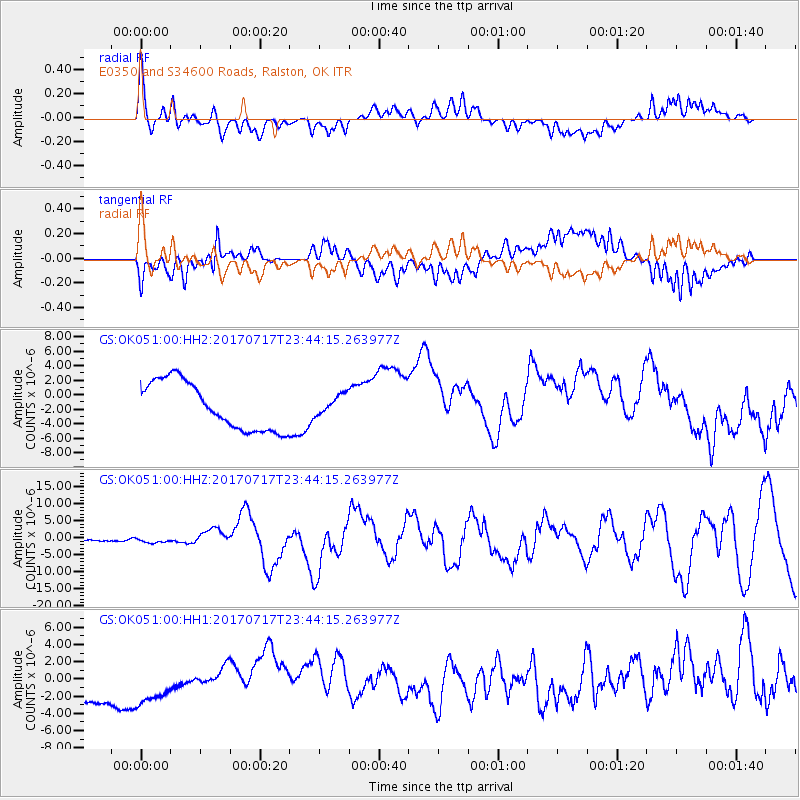
OK051 E0350 and S34600 Roads, Ralston, OK - Earthquake Result Viewer
*The percent match for this event was below the threshold and hence no stack was calculated.
| Earthquake location: |
Komandorskiye Ostrova Region |
| Earthquake latitude/longitude: |
54.2/169.2 |
| Earthquake time(UTC): |
2017/07/17 (198) 23:34:21 GMT |
| Earthquake Depth: |
48 km |
| Earthquake Magnitude: |
7.4 Mi |
| Earthquake Catalog/Contributor: |
NEIC PDE/pt |
|
| Network: |
GS US Geological Survey Networks |
| Station: |
OK051 E0350 and S34600 Roads, Ralston, OK |
| Lat/Lon: |
36.51 N/96.84 W |
| Elevation: |
263 m |
|
| Distance: |
63.5 deg |
| Az: |
63.94 deg |
| Baz: |
319.074 deg |
| Ray Param: |
$rayparam |
*The percent match for this event was below the threshold and hence was not used in the summary stack. |
|
| Radial Match: |
78.30256 % |
| Radial Bump: |
400 |
| Transverse Match: |
59.42207 % |
| Transverse Bump: |
400 |
| SOD ConfigId: |
2140511 |
| Insert Time: |
2017-07-31 15:34:35.718 +0000 |
| GWidth: |
2.5 |
| Max Bumps: |
400 |
| Tol: |
0.001 |
|
Signal To Noise
| Channel | StoN | STA | LTA |
| GS:OK051:00:HHZ:20170717T23:44:15.263977Z | 3.6120677 | 6.652611E-7 | 1.8417737E-7 |
| GS:OK051:00:HH1:20170717T23:44:15.263977Z | 1.1643133 | 3.041396E-6 | 2.61218E-6 |
| GS:OK051:00:HH2:20170717T23:44:15.263977Z | 0.42027345 | 1.386913E-6 | 3.3000254E-6 |
| Arrivals |
| Ps | |
| PpPs | |
| PsPs/PpSs | |


