You are here: Home > Network List > IW - Intermountain West Stations List
> Station PLID Pearl Lake, Idaho, USA > Earthquake Result Viewer
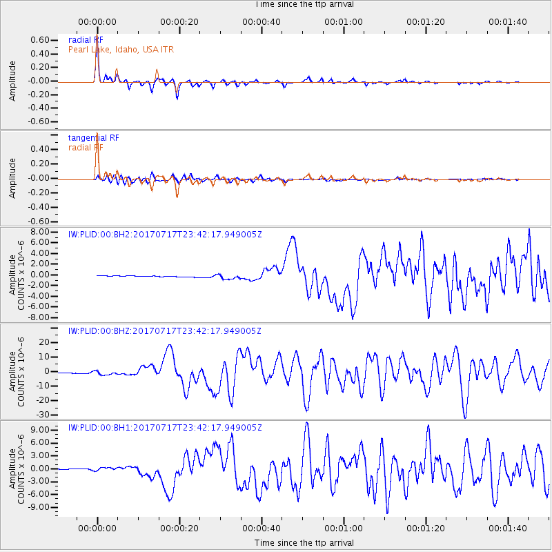
PLID Pearl Lake, Idaho, USA - Earthquake Result Viewer

| Earthquake location: |
Komandorskiye Ostrova Region |
| Earthquake latitude/longitude: |
54.2/169.2 |
| Earthquake time(UTC): |
2017/07/17 (198) 23:34:21 GMT |
| Earthquake Depth: |
48 km |
| Earthquake Magnitude: |
7.4 Mi |
| Earthquake Catalog/Contributor: |
NEIC PDE/pt |
|
| Network: |
IW Intermountain West |
| Station: |
PLID Pearl Lake, Idaho, USA |
| Lat/Lon: |
45.09 N/116.00 W |
| Elevation: |
2164 m |
|
| Distance: |
47.1 deg |
| Az: |
68.855 deg |
| Baz: |
309.326 deg |
| Ray Param: |
0.0700629 |
| Estimated Moho Depth: |
37.25 km |
| Estimated Crust Vp/Vs: |
1.79 |
| Assumed Crust Vp: |
6.571 km/s |
| Estimated Crust Vs: |
3.681 km/s |
| Estimated Crust Poisson's Ratio: |
0.27 |
|
| Radial Match: |
97.24768 % |
| Radial Bump: |
249 |
| Transverse Match: |
90.85853 % |
| Transverse Bump: |
400 |
| SOD ConfigId: |
2140511 |
| Insert Time: |
2017-07-31 15:36:57.273 +0000 |
| GWidth: |
2.5 |
| Max Bumps: |
400 |
| Tol: |
0.001 |
|
Signal To Noise
| Channel | StoN | STA | LTA |
| IW:PLID:00:BHZ:20170717T23:42:17.949005Z | 6.7847347 | 1.3095082E-6 | 1.9300802E-7 |
| IW:PLID:00:BH1:20170717T23:42:17.949005Z | 4.960877 | 4.0011133E-7 | 8.0653344E-8 |
| IW:PLID:00:BH2:20170717T23:42:17.949005Z | 4.8361745 | 4.5858988E-7 | 9.482493E-8 |
| Arrivals |
| Ps | 4.7 SECOND |
| PpPs | 15 SECOND |
| PsPs/PpSs | 20 SECOND |


