You are here: Home > Network List > TA - USArray Transportable Network (new EarthScope stations) Stations List
> Station H31M Peel River, Yukon, CAN > Earthquake Result Viewer
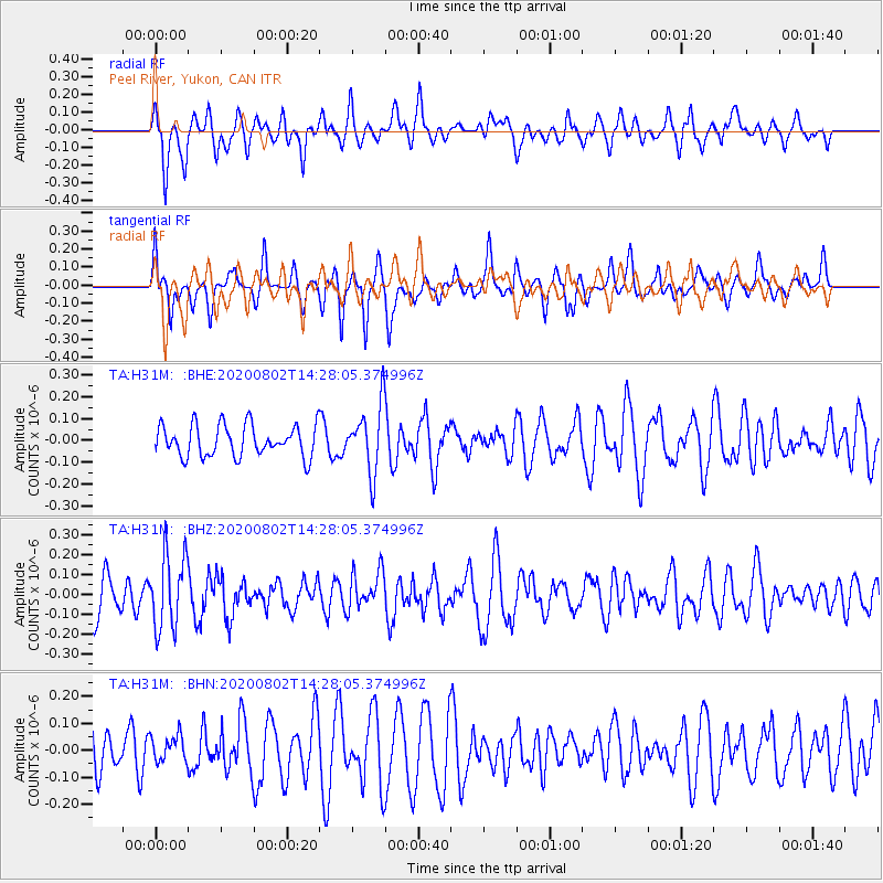
H31M Peel River, Yukon, CAN - Earthquake Result Viewer
*The percent match for this event was below the threshold and hence no stack was calculated.
| Earthquake location: |
Eastern New Guinea Reg., P.N.G. |
| Earthquake latitude/longitude: |
-5.1/145.4 |
| Earthquake time(UTC): |
2020/08/02 (215) 14:15:47 GMT |
| Earthquake Depth: |
122 km |
| Earthquake Magnitude: |
5.4 Mww |
| Earthquake Catalog/Contributor: |
NEIC PDE/us |
|
| Network: |
TA USArray Transportable Network (new EarthScope stations) |
| Station: |
H31M Peel River, Yukon, CAN |
| Lat/Lon: |
65.81 N/134.34 W |
| Elevation: |
642 m |
|
| Distance: |
90.6 deg |
| Az: |
23.968 deg |
| Baz: |
259.055 deg |
| Ray Param: |
$rayparam |
*The percent match for this event was below the threshold and hence was not used in the summary stack. |
|
| Radial Match: |
50.881348 % |
| Radial Bump: |
400 |
| Transverse Match: |
51.190006 % |
| Transverse Bump: |
351 |
| SOD ConfigId: |
21709731 |
| Insert Time: |
2020-08-16 14:25:42.677 +0000 |
| GWidth: |
2.5 |
| Max Bumps: |
400 |
| Tol: |
0.001 |
|
Signal To Noise
| Channel | StoN | STA | LTA |
| TA:H31M: :BHZ:20200802T14:28:05.374996Z | 2.183909 | 1.8536157E-7 | 8.487605E-8 |
| TA:H31M: :BHN:20200802T14:28:05.374996Z | 0.38914177 | 4.9956494E-8 | 1.2837609E-7 |
| TA:H31M: :BHE:20200802T14:28:05.374996Z | 2.1496406 | 1.5380573E-7 | 7.1549515E-8 |
| Arrivals |
| Ps | |
| PpPs | |
| PsPs/PpSs | |


