Y103 Y103 - Earthquake Result Viewer
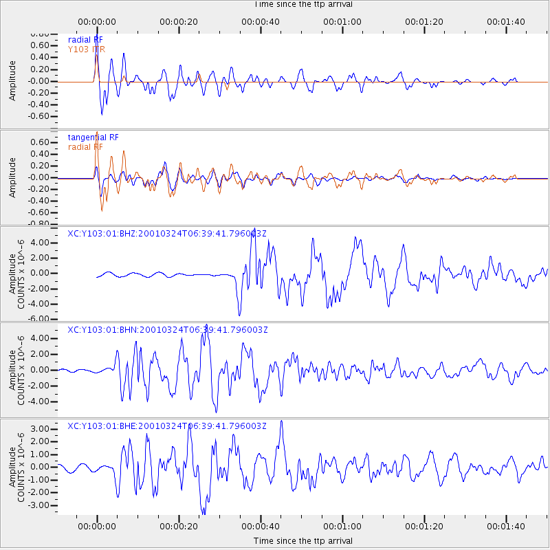
Earthquake location: Western Honshu, Japan
Earthquake latitude/longitude: 34.1/132.5
Earthquake time(UTC): 2001/03/24 (083) 06:27:53 GMT
Earthquake Depth: 50 km
Earthquake Magnitude: 6.4 MB, 6.5 MS, 6.8 MW, 6.4 ME
Earthquake Catalog/Contributor: WHDF/NEIC
Network: XC Yellowstone Intermountain Seismic Array
Station: Y103 Y103
Lat/Lon: 44.58 N/110.81 W
Elevation: 2213 m
Distance: 82.9 deg
Az: 40.061 deg
Baz: 311.63 deg
Ray Param: 0.04649519
Estimated Moho Depth: 20.0 km
Estimated Crust Vp/Vs: 2.10
Assumed Crust Vp: 6.35 km/s
Estimated Crust Vs: 3.027 km/s
Estimated Crust Poisson's Ratio: 0.35
Radial Match: 88.662094 %
Radial Bump: 400
Transverse Match: 88.399864 %
Transverse Bump: 400
SOD ConfigId: 4714
Insert Time: 2010-02-26 15:00:18.613 +0000
GWidth: 2.5
Max Bumps: 400
Tol: 0.001

Signal To Noise

ChannelStoNSTALTA
XC:Y103:01:BHN:20010324T06:39:41.796003Z3.65537956.8562196E-71.8756519E-7
XC:Y103:01:BHE:20010324T06:39:41.796003Z2.63977275.330757E-72.0194001E-7
XC:Y103:01:BHZ:20010324T06:39:41.796003Z6.53693771.3746721E-62.10293E-7
Arrivals
Ps3.5 SECOND
PpPs9.5 SECOND
PsPs/PpSs13 SECOND