Y103 Y103 - Earthquake Result Viewer
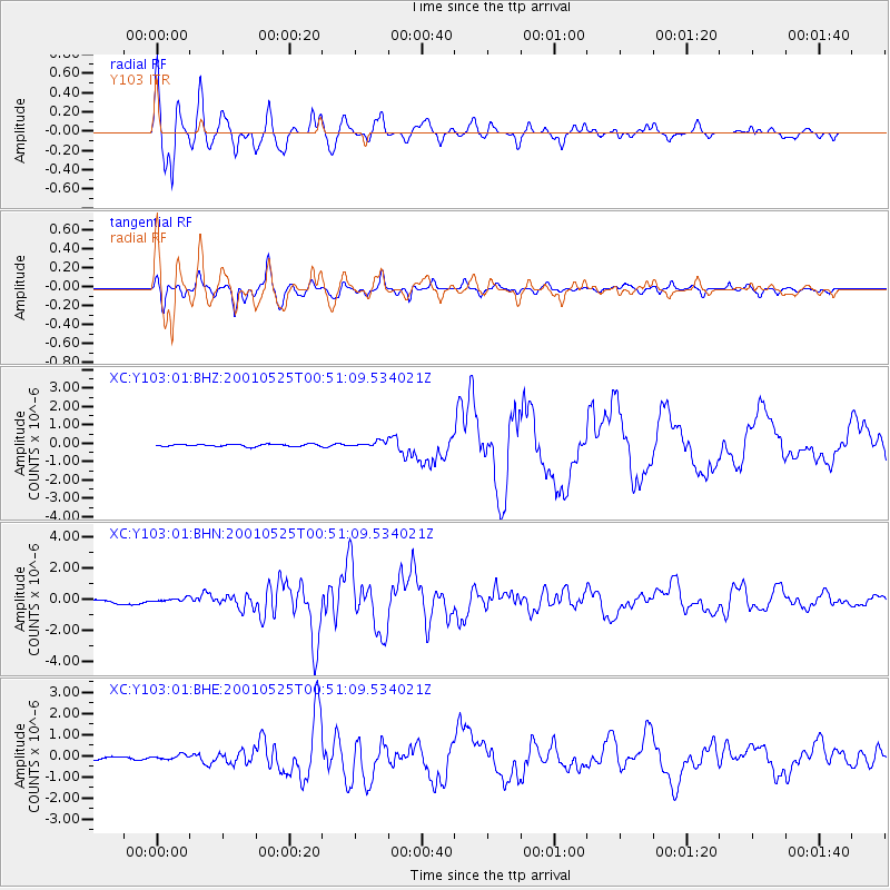
Earthquake location: Kuril Islands
Earthquake latitude/longitude: 44.3/148.4
Earthquake time(UTC): 2001/05/25 (145) 00:40:50 GMT
Earthquake Depth: 33 km
Earthquake Magnitude: 6.1 MB, 6.7 MS, 6.7 MW, 6.6 MW
Earthquake Catalog/Contributor: WHDF/NEIC
Network: XC Yellowstone Intermountain Seismic Array
Station: Y103 Y103
Lat/Lon: 44.58 N/110.81 W
Elevation: 2213 m
Distance: 67.0 deg
Az: 49.684 deg
Baz: 309.959 deg
Ray Param: 0.057175167
Estimated Moho Depth: 61.25 km
Estimated Crust Vp/Vs: 1.66
Assumed Crust Vp: 6.35 km/s
Estimated Crust Vs: 3.825 km/s
Estimated Crust Poisson's Ratio: 0.22
Radial Match: 88.977295 %
Radial Bump: 400
Transverse Match: 93.33735 %
Transverse Bump: 400
SOD ConfigId: 4714
Insert Time: 2010-02-26 15:00:19.950 +0000
GWidth: 2.5
Max Bumps: 400
Tol: 0.001

Signal To Noise

ChannelStoNSTALTA
XC:Y103:01:BHN:20010525T00:51:09.534021Z1.00779771.202339E-71.1930362E-7
XC:Y103:01:BHE:20010525T00:51:09.534021Z1.18795811.0370917E-78.730036E-8
XC:Y103:01:BHZ:20010525T00:51:09.534021Z2.4340541.4864001E-76.106686E-8
Arrivals
Ps6.6 SECOND
PpPs25 SECOND
PsPs/PpSs31 SECOND