You are here: Home > Network List > CN - Canadian National Seismograph Network Stations List
> Station INK INUVIK, NT > Earthquake Result Viewer
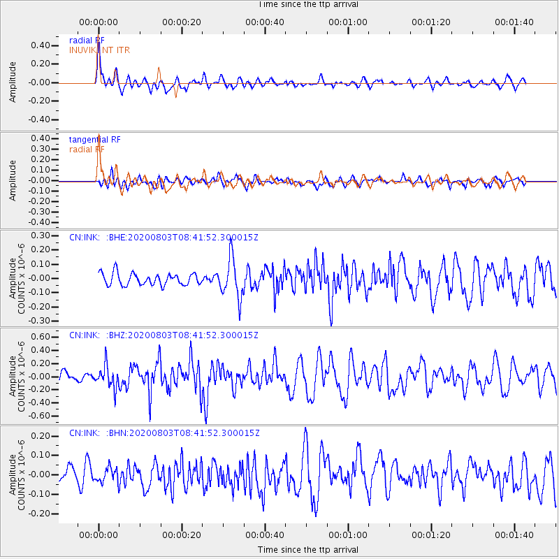
INK INUVIK, NT - Earthquake Result Viewer
*The percent match for this event was below the threshold and hence no stack was calculated.
| Earthquake location: |
Mariana Islands Region |
| Earthquake latitude/longitude: |
17.1/147.3 |
| Earthquake time(UTC): |
2020/08/03 (216) 08:31:10 GMT |
| Earthquake Depth: |
10 km |
| Earthquake Magnitude: |
5.6 mww |
| Earthquake Catalog/Contributor: |
NEIC PDE/us |
|
| Network: |
CN Canadian National Seismograph Network |
| Station: |
INK INUVIK, NT |
| Lat/Lon: |
68.31 N/133.53 W |
| Elevation: |
44 m |
|
| Distance: |
70.3 deg |
| Az: |
22.826 deg |
| Baz: |
266.421 deg |
| Ray Param: |
$rayparam |
*The percent match for this event was below the threshold and hence was not used in the summary stack. |
|
| Radial Match: |
79.482574 % |
| Radial Bump: |
400 |
| Transverse Match: |
55.911545 % |
| Transverse Bump: |
400 |
| SOD ConfigId: |
21709731 |
| Insert Time: |
2020-08-17 08:39:23.921 +0000 |
| GWidth: |
2.5 |
| Max Bumps: |
400 |
| Tol: |
0.001 |
|
Signal To Noise
| Channel | StoN | STA | LTA |
| CN:INK: :BHZ:20200803T08:41:52.300015Z | 2.0058093 | 1.7174105E-7 | 8.562182E-8 |
| CN:INK: :BHN:20200803T08:41:52.300015Z | 0.7009587 | 3.720744E-8 | 5.3080782E-8 |
| CN:INK: :BHE:20200803T08:41:52.300015Z | 3.4273434 | 1.4086147E-7 | 4.1099316E-8 |
| Arrivals |
| Ps | |
| PpPs | |
| PsPs/PpSs | |


