You are here: Home > Network List > TA - USArray Transportable Network (new EarthScope stations) Stations List
> Station F26K Sheenjek River, AK, USA > Earthquake Result Viewer
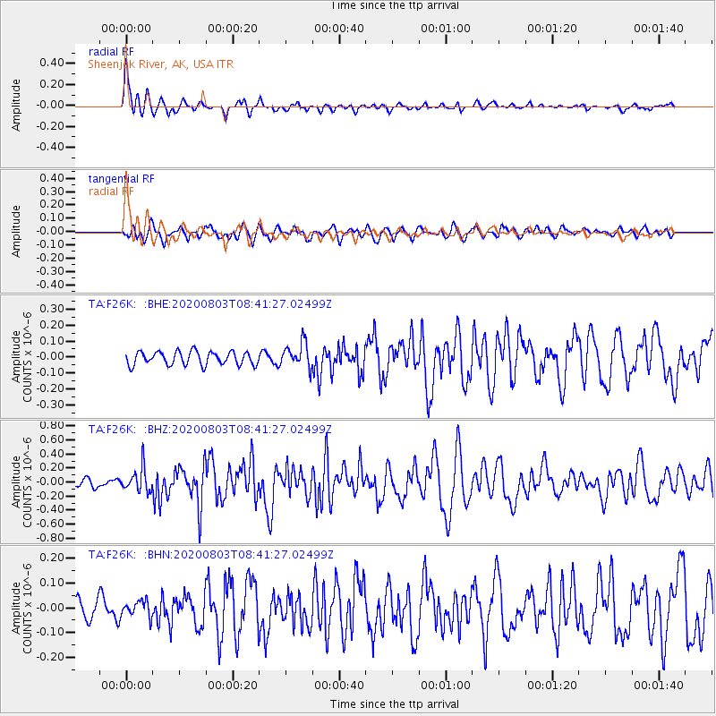
F26K Sheenjek River, AK, USA - Earthquake Result Viewer
*The percent match for this event was below the threshold and hence no stack was calculated.
| Earthquake location: |
Mariana Islands Region |
| Earthquake latitude/longitude: |
17.1/147.3 |
| Earthquake time(UTC): |
2020/08/03 (216) 08:31:10 GMT |
| Earthquake Depth: |
10 km |
| Earthquake Magnitude: |
5.6 mww |
| Earthquake Catalog/Contributor: |
NEIC PDE/us |
|
| Network: |
TA USArray Transportable Network (new EarthScope stations) |
| Station: |
F26K Sheenjek River, AK, USA |
| Lat/Lon: |
67.69 N/144.15 W |
| Elevation: |
683 m |
|
| Distance: |
66.2 deg |
| Az: |
22.842 deg |
| Baz: |
256.585 deg |
| Ray Param: |
$rayparam |
*The percent match for this event was below the threshold and hence was not used in the summary stack. |
|
| Radial Match: |
76.9328 % |
| Radial Bump: |
377 |
| Transverse Match: |
61.35769 % |
| Transverse Bump: |
400 |
| SOD ConfigId: |
21709731 |
| Insert Time: |
2020-08-17 08:46:35.710 +0000 |
| GWidth: |
2.5 |
| Max Bumps: |
400 |
| Tol: |
0.001 |
|
Signal To Noise
| Channel | StoN | STA | LTA |
| TA:F26K: :BHZ:20200803T08:41:27.02499Z | 2.8227208 | 1.700747E-7 | 6.025205E-8 |
| TA:F26K: :BHN:20200803T08:41:27.02499Z | 0.60631704 | 3.1970927E-8 | 5.2729725E-8 |
| TA:F26K: :BHE:20200803T08:41:27.02499Z | 1.8540903 | 7.721488E-8 | 4.1645695E-8 |
| Arrivals |
| Ps | |
| PpPs | |
| PsPs/PpSs | |


