You are here: Home > Network List > TA - USArray Transportable Network (new EarthScope stations) Stations List
> Station H31M Peel River, Yukon, CAN > Earthquake Result Viewer
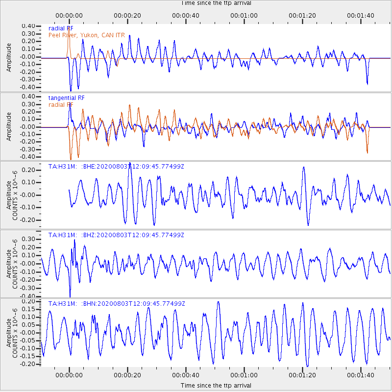
H31M Peel River, Yukon, CAN - Earthquake Result Viewer
*The percent match for this event was below the threshold and hence no stack was calculated.
| Earthquake location: |
Northern Chile |
| Earthquake latitude/longitude: |
-19.6/-69.3 |
| Earthquake time(UTC): |
2020/08/03 (216) 11:56:52 GMT |
| Earthquake Depth: |
104 km |
| Earthquake Magnitude: |
5.5 Mww |
| Earthquake Catalog/Contributor: |
NEIC PDE/us |
|
| Network: |
TA USArray Transportable Network (new EarthScope stations) |
| Station: |
H31M Peel River, Yukon, CAN |
| Lat/Lon: |
65.81 N/134.34 W |
| Elevation: |
642 m |
|
| Distance: |
98.1 deg |
| Az: |
337.82 deg |
| Baz: |
120.281 deg |
| Ray Param: |
$rayparam |
*The percent match for this event was below the threshold and hence was not used in the summary stack. |
|
| Radial Match: |
52.140846 % |
| Radial Bump: |
400 |
| Transverse Match: |
51.419636 % |
| Transverse Bump: |
400 |
| SOD ConfigId: |
21709731 |
| Insert Time: |
2020-08-17 12:16:54.324 +0000 |
| GWidth: |
2.5 |
| Max Bumps: |
400 |
| Tol: |
0.001 |
|
Signal To Noise
| Channel | StoN | STA | LTA |
| TA:H31M: :BHZ:20200803T12:09:45.77499Z | 2.4994545 | 1.5285397E-7 | 6.1154935E-8 |
| TA:H31M: :BHN:20200803T12:09:45.77499Z | 0.7117673 | 5.9381748E-8 | 8.3428596E-8 |
| TA:H31M: :BHE:20200803T12:09:45.77499Z | 1.0635109 | 1.0847604E-7 | 1.0199805E-7 |
| Arrivals |
| Ps | |
| PpPs | |
| PsPs/PpSs | |


