You are here: Home > Network List > UU - University of Utah Regional Network Stations List
> Station FOR4 Blundell West, UT, USA > Earthquake Result Viewer
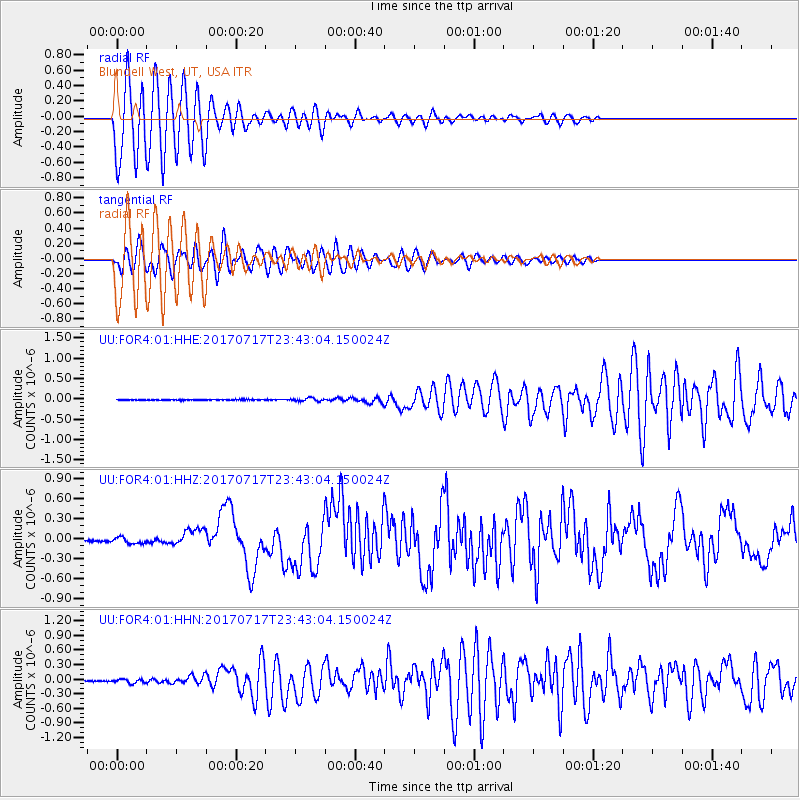
FOR4 Blundell West, UT, USA - Earthquake Result Viewer
*The percent match for this event was below the threshold and hence no stack was calculated.
| Earthquake location: |
Komandorskiye Ostrova Region |
| Earthquake latitude/longitude: |
54.2/169.2 |
| Earthquake time(UTC): |
2017/07/17 (198) 23:34:21 GMT |
| Earthquake Depth: |
48 km |
| Earthquake Magnitude: |
7.4 Mi |
| Earthquake Catalog/Contributor: |
NEIC PDE/pt |
|
| Network: |
UU University of Utah Regional Network |
| Station: |
FOR4 Blundell West, UT, USA |
| Lat/Lon: |
38.50 N/112.90 W |
| Elevation: |
1657 m |
|
| Distance: |
53.3 deg |
| Az: |
73.232 deg |
| Baz: |
314.197 deg |
| Ray Param: |
$rayparam |
*The percent match for this event was below the threshold and hence was not used in the summary stack. |
|
| Radial Match: |
88.661285 % |
| Radial Bump: |
400 |
| Transverse Match: |
90.988045 % |
| Transverse Bump: |
400 |
| SOD ConfigId: |
2140511 |
| Insert Time: |
2017-07-31 15:42:57.115 +0000 |
| GWidth: |
2.5 |
| Max Bumps: |
400 |
| Tol: |
0.001 |
|
Signal To Noise
| Channel | StoN | STA | LTA |
| UU:FOR4:01:HHZ:20170717T23:43:04.150024Z | 4.023617 | 4.6664123E-8 | 1.1597557E-8 |
| UU:FOR4:01:HHN:20170717T23:43:04.150024Z | 3.193715 | 4.1245475E-8 | 1.2914575E-8 |
| UU:FOR4:01:HHE:20170717T23:43:04.150024Z | 3.6606965 | 3.7886746E-8 | 1.03496E-8 |
| Arrivals |
| Ps | |
| PpPs | |
| PsPs/PpSs | |


