You are here: Home > Network List > AV - Alaska Volcano Observatory Stations List
> Station MAPS Pakushin Southeast, Makushin Volcano, Alaska > Earthquake Result Viewer
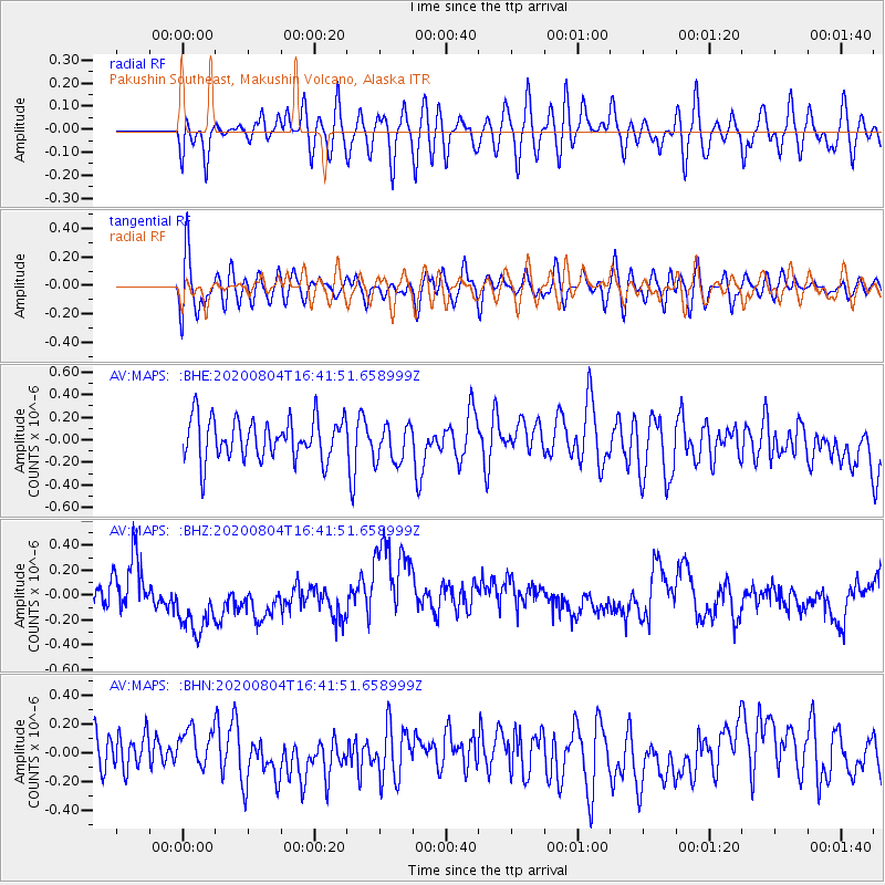
MAPS Pakushin Southeast, Makushin Volcano, Alaska - Earthquake Result Viewer
*The percent match for this event was below the threshold and hence no stack was calculated.
| Earthquake location: |
Santa Cruz Islands |
| Earthquake latitude/longitude: |
-12.6/166.6 |
| Earthquake time(UTC): |
2020/08/04 (217) 16:31:19 GMT |
| Earthquake Depth: |
70 km |
| Earthquake Magnitude: |
5.6 mww |
| Earthquake Catalog/Contributor: |
NEIC PDE/us |
|
| Network: |
AV Alaska Volcano Observatory |
| Station: |
MAPS Pakushin Southeast, Makushin Volcano, Alaska |
| Lat/Lon: |
53.81 N/166.94 W |
| Elevation: |
333 m |
|
| Distance: |
69.9 deg |
| Az: |
16.344 deg |
| Baz: |
207.596 deg |
| Ray Param: |
$rayparam |
*The percent match for this event was below the threshold and hence was not used in the summary stack. |
|
| Radial Match: |
51.359913 % |
| Radial Bump: |
400 |
| Transverse Match: |
45.711567 % |
| Transverse Bump: |
400 |
| SOD ConfigId: |
21709731 |
| Insert Time: |
2020-08-18 16:35:58.905 +0000 |
| GWidth: |
2.5 |
| Max Bumps: |
400 |
| Tol: |
0.001 |
|
Signal To Noise
| Channel | StoN | STA | LTA |
| AV:MAPS: :BHZ:20200804T16:41:51.658999Z | 1.5399493 | 3.7892102E-7 | 2.460607E-7 |
| AV:MAPS: :BHN:20200804T16:41:51.658999Z | 0.90894085 | 1.4389128E-7 | 1.5830653E-7 |
| AV:MAPS: :BHE:20200804T16:41:51.658999Z | 0.9586445 | 1.7257462E-7 | 1.8001941E-7 |
| Arrivals |
| Ps | |
| PpPs | |
| PsPs/PpSs | |


