You are here: Home > Network List > CI - Caltech Regional Seismic Network Stations List
> Station SWS Sam W. Stewart, Westmorland, CA, USA > Earthquake Result Viewer
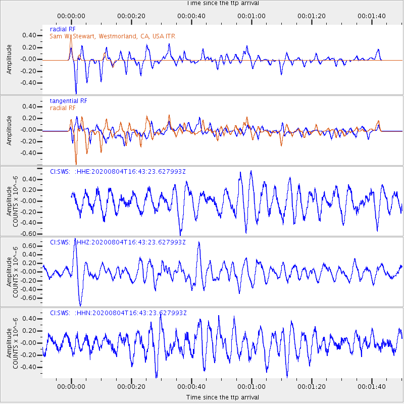
SWS Sam W. Stewart, Westmorland, CA, USA - Earthquake Result Viewer
*The percent match for this event was below the threshold and hence no stack was calculated.
| Earthquake location: |
Santa Cruz Islands |
| Earthquake latitude/longitude: |
-12.6/166.6 |
| Earthquake time(UTC): |
2020/08/04 (217) 16:31:19 GMT |
| Earthquake Depth: |
70 km |
| Earthquake Magnitude: |
5.6 mww |
| Earthquake Catalog/Contributor: |
NEIC PDE/us |
|
| Network: |
CI Caltech Regional Seismic Network |
| Station: |
SWS Sam W. Stewart, Westmorland, CA, USA |
| Lat/Lon: |
32.94 N/115.80 W |
| Elevation: |
140 m |
|
| Distance: |
86.6 deg |
| Az: |
55.358 deg |
| Baz: |
252.777 deg |
| Ray Param: |
$rayparam |
*The percent match for this event was below the threshold and hence was not used in the summary stack. |
|
| Radial Match: |
72.51743 % |
| Radial Bump: |
349 |
| Transverse Match: |
61.569653 % |
| Transverse Bump: |
400 |
| SOD ConfigId: |
21709731 |
| Insert Time: |
2020-08-18 16:39:16.504 +0000 |
| GWidth: |
2.5 |
| Max Bumps: |
400 |
| Tol: |
0.001 |
|
Signal To Noise
| Channel | StoN | STA | LTA |
| CI:SWS: :HHZ:20200804T16:43:23.627993Z | 4.0945244 | 4.2763492E-7 | 1.0444068E-7 |
| CI:SWS: :HHN:20200804T16:43:23.627993Z | 0.9786061 | 9.8033134E-8 | 1.00176294E-7 |
| CI:SWS: :HHE:20200804T16:43:23.627993Z | 1.0370317 | 1.4585291E-7 | 1.406446E-7 |
| Arrivals |
| Ps | |
| PpPs | |
| PsPs/PpSs | |


