You are here: Home > Network List > CU - Caribbean Network (USGS) Stations List
> Station BBGH Gun Hill, Barbados > Earthquake Result Viewer
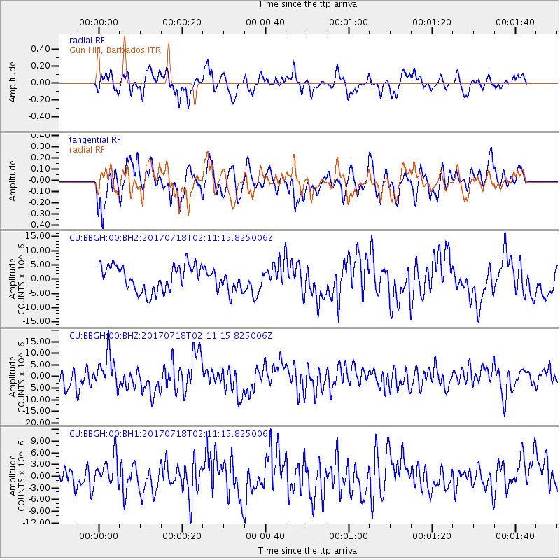
BBGH Gun Hill, Barbados - Earthquake Result Viewer
*The percent match for this event was below the threshold and hence no stack was calculated.
| Earthquake location: |
Near Coast Of Peru |
| Earthquake latitude/longitude: |
-16.4/-73.6 |
| Earthquake time(UTC): |
2017/07/18 (199) 02:05:19 GMT |
| Earthquake Depth: |
44 km |
| Earthquake Magnitude: |
6.4 Mww |
| Earthquake Catalog/Contributor: |
NEIC PDE/us |
|
| Network: |
CU Caribbean Network (USGS) |
| Station: |
BBGH Gun Hill, Barbados |
| Lat/Lon: |
13.14 N/59.56 W |
| Elevation: |
180 m |
|
| Distance: |
32.5 deg |
| Az: |
26.123 deg |
| Baz: |
205.71 deg |
| Ray Param: |
$rayparam |
*The percent match for this event was below the threshold and hence was not used in the summary stack. |
|
| Radial Match: |
66.78755 % |
| Radial Bump: |
400 |
| Transverse Match: |
61.898872 % |
| Transverse Bump: |
400 |
| SOD ConfigId: |
2140511 |
| Insert Time: |
2017-07-31 17:58:33.525 +0000 |
| GWidth: |
2.5 |
| Max Bumps: |
400 |
| Tol: |
0.001 |
|
Signal To Noise
| Channel | StoN | STA | LTA |
| CU:BBGH:00:BHZ:20170718T02:11:15.825006Z | 2.1787786 | 7.66876E-6 | 3.519752E-6 |
| CU:BBGH:00:BH1:20170718T02:11:15.825006Z | 1.9178631 | 3.9084252E-6 | 2.0379061E-6 |
| CU:BBGH:00:BH2:20170718T02:11:15.825006Z | 0.93087476 | 4.148068E-6 | 4.4560966E-6 |
| Arrivals |
| Ps | |
| PpPs | |
| PsPs/PpSs | |


