You are here: Home > Network List > GS - US Geological Survey Networks Stations List
> Station KAN09 East Station, Caldwell, KS, USA > Earthquake Result Viewer
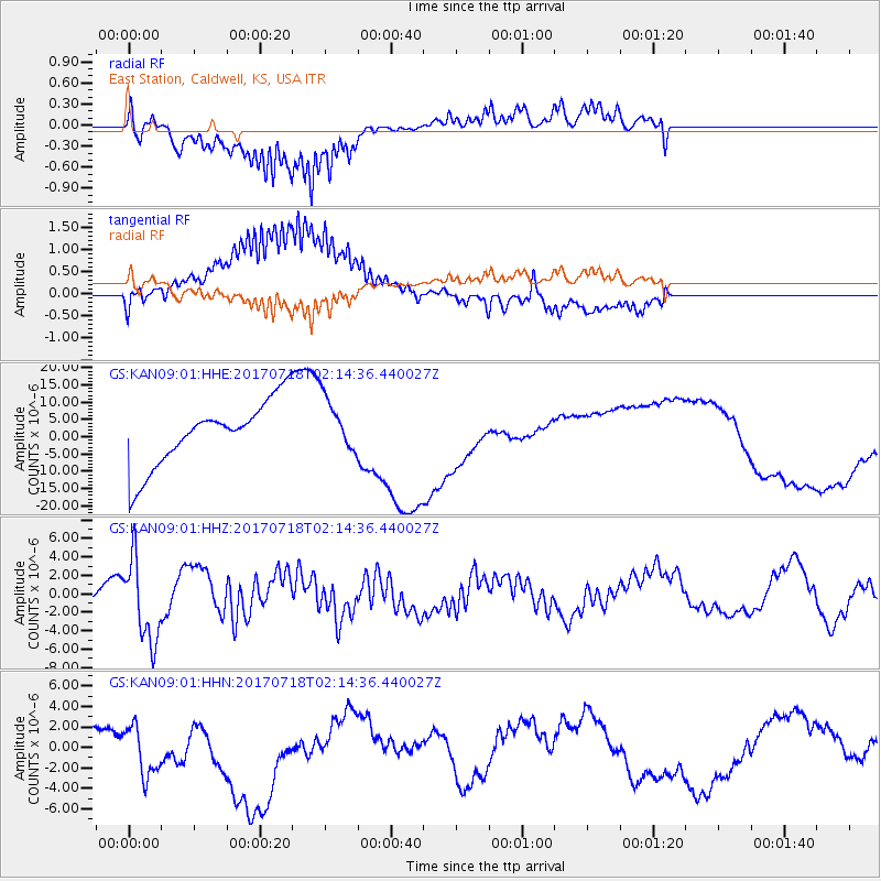
KAN09 East Station, Caldwell, KS, USA - Earthquake Result Viewer
*The percent match for this event was below the threshold and hence no stack was calculated.
| Earthquake location: |
Near Coast Of Peru |
| Earthquake latitude/longitude: |
-16.4/-73.6 |
| Earthquake time(UTC): |
2017/07/18 (199) 02:05:19 GMT |
| Earthquake Depth: |
44 km |
| Earthquake Magnitude: |
6.4 Mww |
| Earthquake Catalog/Contributor: |
NEIC PDE/us |
|
| Network: |
GS US Geological Survey Networks |
| Station: |
KAN09 East Station, Caldwell, KS, USA |
| Lat/Lon: |
37.14 N/97.62 W |
| Elevation: |
371 m |
|
| Distance: |
57.9 deg |
| Az: |
337.413 deg |
| Baz: |
152.528 deg |
| Ray Param: |
$rayparam |
*The percent match for this event was below the threshold and hence was not used in the summary stack. |
|
| Radial Match: |
73.88629 % |
| Radial Bump: |
400 |
| Transverse Match: |
65.099724 % |
| Transverse Bump: |
400 |
| SOD ConfigId: |
2140511 |
| Insert Time: |
2017-07-31 17:59:51.753 +0000 |
| GWidth: |
2.5 |
| Max Bumps: |
400 |
| Tol: |
0.001 |
|
Signal To Noise
| Channel | StoN | STA | LTA |
| GS:KAN09:01:HHZ:20170718T02:14:36.440027Z | 2.3092053 | 4.47396E-6 | 1.9374459E-6 |
| GS:KAN09:01:HHN:20170718T02:14:36.440027Z | 2.4012907 | 2.8879683E-6 | 1.2026734E-6 |
| GS:KAN09:01:HHE:20170718T02:14:36.440027Z | 0.86655307 | 8.148133E-6 | 9.402924E-6 |
| Arrivals |
| Ps | |
| PpPs | |
| PsPs/PpSs | |


