You are here: Home > Network List > TA - USArray Transportable Network (new EarthScope stations) Stations List
> Station C16K Lisburne Hills, AK, USA > Earthquake Result Viewer
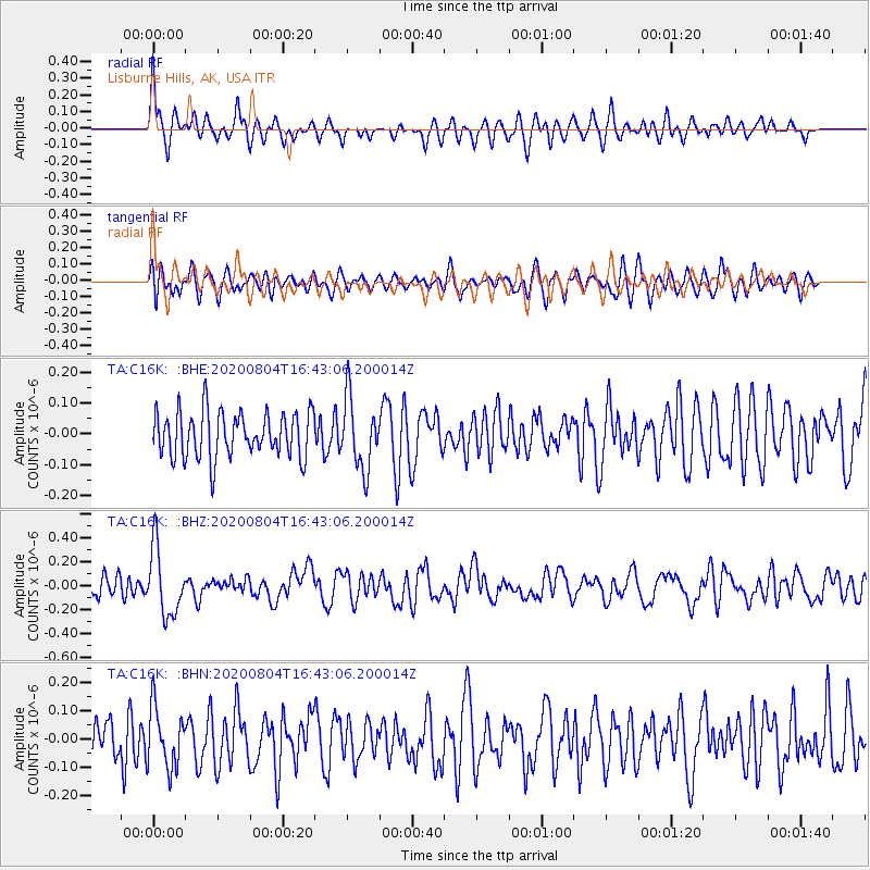
C16K Lisburne Hills, AK, USA - Earthquake Result Viewer
*The percent match for this event was below the threshold and hence no stack was calculated.
| Earthquake location: |
Santa Cruz Islands |
| Earthquake latitude/longitude: |
-12.6/166.6 |
| Earthquake time(UTC): |
2020/08/04 (217) 16:31:19 GMT |
| Earthquake Depth: |
70 km |
| Earthquake Magnitude: |
5.6 mww |
| Earthquake Catalog/Contributor: |
NEIC PDE/us |
|
| Network: |
TA USArray Transportable Network (new EarthScope stations) |
| Station: |
C16K Lisburne Hills, AK, USA |
| Lat/Lon: |
68.27 N/165.34 W |
| Elevation: |
102 m |
|
| Distance: |
83.1 deg |
| Az: |
10.159 deg |
| Baz: |
207.548 deg |
| Ray Param: |
$rayparam |
*The percent match for this event was below the threshold and hence was not used in the summary stack. |
|
| Radial Match: |
60.806625 % |
| Radial Bump: |
400 |
| Transverse Match: |
57.939068 % |
| Transverse Bump: |
400 |
| SOD ConfigId: |
21709731 |
| Insert Time: |
2020-08-18 16:45:17.701 +0000 |
| GWidth: |
2.5 |
| Max Bumps: |
400 |
| Tol: |
0.001 |
|
Signal To Noise
| Channel | StoN | STA | LTA |
| TA:C16K: :BHZ:20200804T16:43:06.200014Z | 2.8879411 | 2.8040145E-7 | 9.7093896E-8 |
| TA:C16K: :BHN:20200804T16:43:06.200014Z | 1.4915872 | 1.05718364E-7 | 7.0876425E-8 |
| TA:C16K: :BHE:20200804T16:43:06.200014Z | 1.5583845 | 1.1493587E-7 | 7.375321E-8 |
| Arrivals |
| Ps | |
| PpPs | |
| PsPs/PpSs | |


