You are here: Home > Network List > TA - USArray Transportable Network (new EarthScope stations) Stations List
> Station K13K Kusilvak Mountain, AK, USA > Earthquake Result Viewer
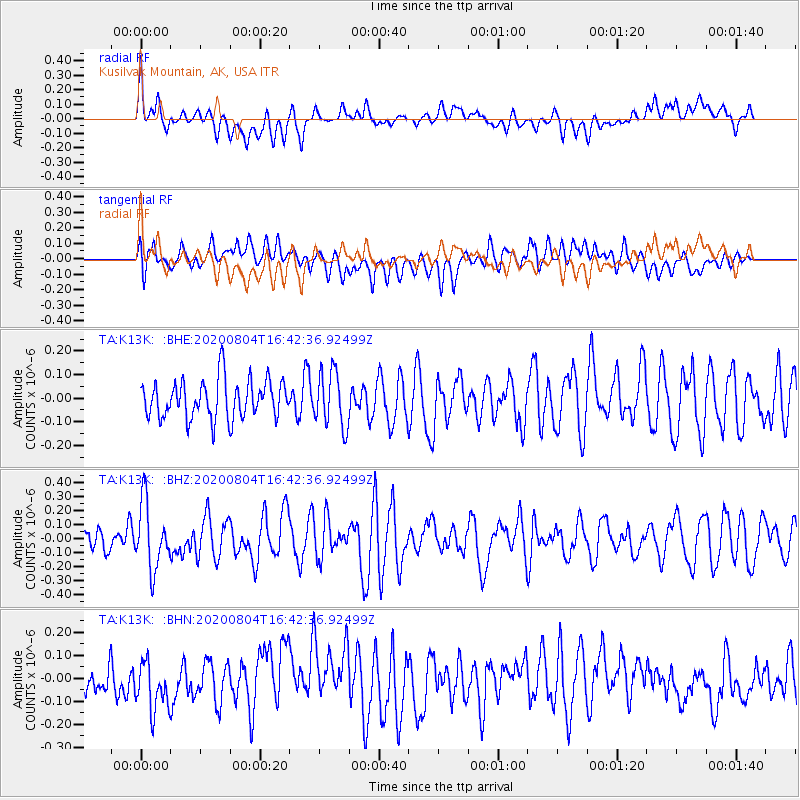
K13K Kusilvak Mountain, AK, USA - Earthquake Result Viewer
*The percent match for this event was below the threshold and hence no stack was calculated.
| Earthquake location: |
Santa Cruz Islands |
| Earthquake latitude/longitude: |
-12.6/166.6 |
| Earthquake time(UTC): |
2020/08/04 (217) 16:31:19 GMT |
| Earthquake Depth: |
70 km |
| Earthquake Magnitude: |
5.6 mww |
| Earthquake Catalog/Contributor: |
NEIC PDE/us |
|
| Network: |
TA USArray Transportable Network (new EarthScope stations) |
| Station: |
K13K Kusilvak Mountain, AK, USA |
| Lat/Lon: |
61.93 N/164.66 W |
| Elevation: |
204 m |
|
| Distance: |
77.6 deg |
| Az: |
13.464 deg |
| Baz: |
208.725 deg |
| Ray Param: |
$rayparam |
*The percent match for this event was below the threshold and hence was not used in the summary stack. |
|
| Radial Match: |
60.322636 % |
| Radial Bump: |
400 |
| Transverse Match: |
46.557125 % |
| Transverse Bump: |
400 |
| SOD ConfigId: |
21709731 |
| Insert Time: |
2020-08-18 16:46:41.125 +0000 |
| GWidth: |
2.5 |
| Max Bumps: |
400 |
| Tol: |
0.001 |
|
Signal To Noise
| Channel | StoN | STA | LTA |
| TA:K13K: :BHZ:20200804T16:42:36.92499Z | 2.5389616 | 2.3491305E-7 | 9.252328E-8 |
| TA:K13K: :BHN:20200804T16:42:36.92499Z | 1.0804658 | 1.1971717E-7 | 1.1080145E-7 |
| TA:K13K: :BHE:20200804T16:42:36.92499Z | 1.4422499 | 1.1712294E-7 | 8.120849E-8 |
| Arrivals |
| Ps | |
| PpPs | |
| PsPs/PpSs | |


