You are here: Home > Network List > US - United States National Seismic Network Stations List
> Station NEW Newport, Washington, USA > Earthquake Result Viewer
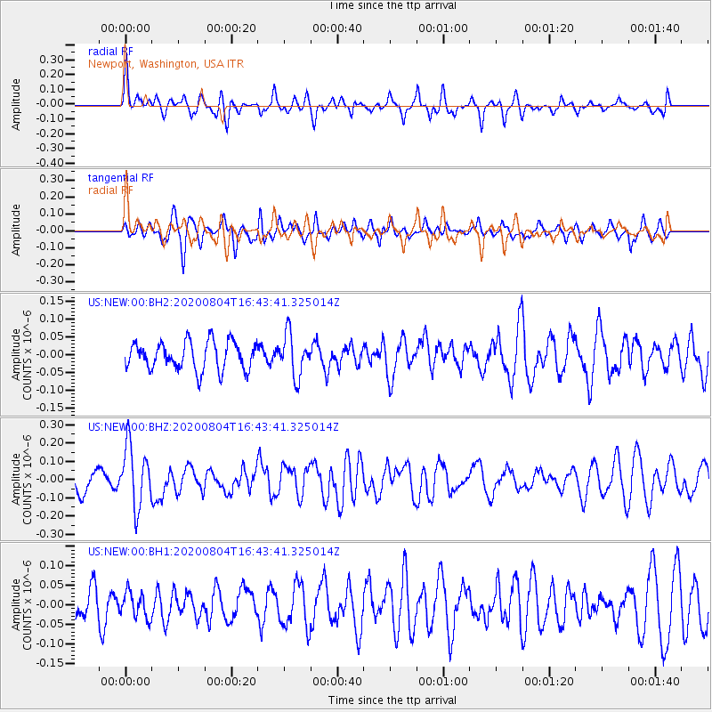
NEW Newport, Washington, USA - Earthquake Result Viewer
*The percent match for this event was below the threshold and hence no stack was calculated.
| Earthquake location: |
Santa Cruz Islands |
| Earthquake latitude/longitude: |
-12.6/166.6 |
| Earthquake time(UTC): |
2020/08/04 (217) 16:31:19 GMT |
| Earthquake Depth: |
70 km |
| Earthquake Magnitude: |
5.6 mww |
| Earthquake Catalog/Contributor: |
NEIC PDE/us |
|
| Network: |
US United States National Seismic Network |
| Station: |
NEW Newport, Washington, USA |
| Lat/Lon: |
48.26 N/117.12 W |
| Elevation: |
760 m |
|
| Distance: |
90.4 deg |
| Az: |
40.477 deg |
| Baz: |
251.517 deg |
| Ray Param: |
$rayparam |
*The percent match for this event was below the threshold and hence was not used in the summary stack. |
|
| Radial Match: |
60.435844 % |
| Radial Bump: |
400 |
| Transverse Match: |
61.048473 % |
| Transverse Bump: |
385 |
| SOD ConfigId: |
21709731 |
| Insert Time: |
2020-08-18 16:48:53.629 +0000 |
| GWidth: |
2.5 |
| Max Bumps: |
400 |
| Tol: |
0.001 |
|
Signal To Noise
| Channel | StoN | STA | LTA |
| US:NEW:00:BHZ:20200804T16:43:41.325014Z | 3.2844565 | 1.6833471E-7 | 5.1251924E-8 |
| US:NEW:00:BH1:20200804T16:43:41.325014Z | 1.0953345 | 3.3232247E-8 | 3.0339816E-8 |
| US:NEW:00:BH2:20200804T16:43:41.325014Z | 1.500471 | 5.960897E-8 | 3.972684E-8 |
| Arrivals |
| Ps | |
| PpPs | |
| PsPs/PpSs | |


