You are here: Home > Network List > IW - Intermountain West Stations List
> Station MOOW Moose Ponds, Wyoming, USA > Earthquake Result Viewer
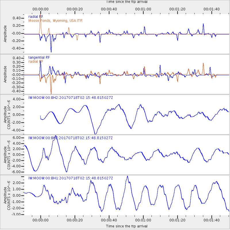
MOOW Moose Ponds, Wyoming, USA - Earthquake Result Viewer
*The percent match for this event was below the threshold and hence no stack was calculated.
| Earthquake location: |
Near Coast Of Peru |
| Earthquake latitude/longitude: |
-16.4/-73.6 |
| Earthquake time(UTC): |
2017/07/18 (199) 02:05:19 GMT |
| Earthquake Depth: |
44 km |
| Earthquake Magnitude: |
6.4 Mww |
| Earthquake Catalog/Contributor: |
NEIC PDE/us |
|
| Network: |
IW Intermountain West |
| Station: |
MOOW Moose Ponds, Wyoming, USA |
| Lat/Lon: |
43.75 N/110.74 W |
| Elevation: |
2128 m |
|
| Distance: |
68.8 deg |
| Az: |
332.016 deg |
| Baz: |
141.577 deg |
| Ray Param: |
$rayparam |
*The percent match for this event was below the threshold and hence was not used in the summary stack. |
|
| Radial Match: |
83.03399 % |
| Radial Bump: |
400 |
| Transverse Match: |
75.71587 % |
| Transverse Bump: |
350 |
| SOD ConfigId: |
2140511 |
| Insert Time: |
2017-07-31 18:01:30.548 +0000 |
| GWidth: |
2.5 |
| Max Bumps: |
400 |
| Tol: |
0.001 |
|
Signal To Noise
| Channel | StoN | STA | LTA |
| IW:MOOW:00:BHZ:20170718T02:15:48.815027Z | 1.3454975 | 2.0839668E-6 | 1.5488448E-6 |
| IW:MOOW:00:BH1:20170718T02:15:48.815027Z | 1.2213442 | 9.1157864E-7 | 7.4637325E-7 |
| IW:MOOW:00:BH2:20170718T02:15:48.815027Z | 2.9228868 | 3.5524454E-6 | 1.2153893E-6 |
| Arrivals |
| Ps | |
| PpPs | |
| PsPs/PpSs | |


