You are here: Home > Network List > US - United States National Seismic Network Stations List
> Station HDIL Hopedale, Illinois, USA > Earthquake Result Viewer
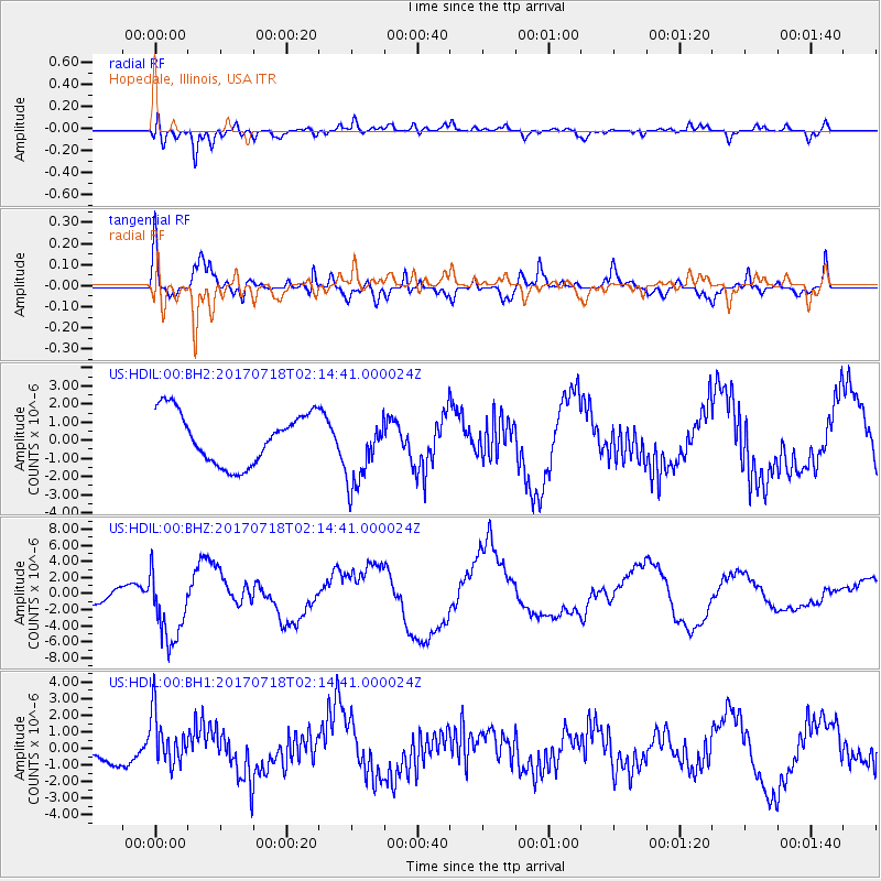
HDIL Hopedale, Illinois, USA - Earthquake Result Viewer
*The percent match for this event was below the threshold and hence no stack was calculated.
| Earthquake location: |
Near Coast Of Peru |
| Earthquake latitude/longitude: |
-16.4/-73.6 |
| Earthquake time(UTC): |
2017/07/18 (199) 02:05:19 GMT |
| Earthquake Depth: |
44 km |
| Earthquake Magnitude: |
6.4 Mww |
| Earthquake Catalog/Contributor: |
NEIC PDE/us |
|
| Network: |
US United States National Seismic Network |
| Station: |
HDIL Hopedale, Illinois, USA |
| Lat/Lon: |
40.56 N/89.29 W |
| Elevation: |
219 m |
|
| Distance: |
58.5 deg |
| Az: |
346.017 deg |
| Baz: |
162.278 deg |
| Ray Param: |
$rayparam |
*The percent match for this event was below the threshold and hence was not used in the summary stack. |
|
| Radial Match: |
59.743786 % |
| Radial Bump: |
400 |
| Transverse Match: |
72.22573 % |
| Transverse Bump: |
400 |
| SOD ConfigId: |
2140511 |
| Insert Time: |
2017-07-31 18:03:18.234 +0000 |
| GWidth: |
2.5 |
| Max Bumps: |
400 |
| Tol: |
0.001 |
|
Signal To Noise
| Channel | StoN | STA | LTA |
| US:HDIL:00:BHZ:20170718T02:14:41.000024Z | 3.0317864 | 4.487008E-6 | 1.4799881E-6 |
| US:HDIL:00:BH1:20170718T02:14:41.000024Z | 1.4077712 | 1.6249792E-6 | 1.154292E-6 |
| US:HDIL:00:BH2:20170718T02:14:41.000024Z | 1.4009372 | 1.9793924E-6 | 1.4129058E-6 |
| Arrivals |
| Ps | |
| PpPs | |
| PsPs/PpSs | |


