You are here: Home > Network List > AV - Alaska Volcano Observatory Stations List
> Station PLBL Mt. Peulik Volcano, Alaska > Earthquake Result Viewer
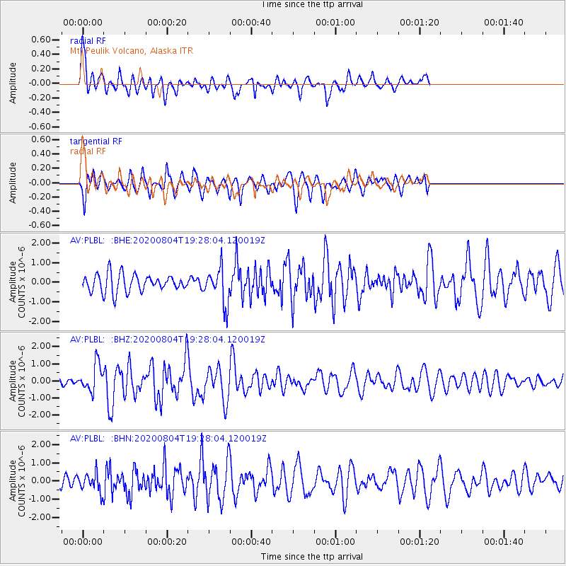
PLBL Mt. Peulik Volcano, Alaska - Earthquake Result Viewer
*The percent match for this event was below the threshold and hence no stack was calculated.
| Earthquake location: |
Near Coast Of Guatemala |
| Earthquake latitude/longitude: |
13.4/-92.0 |
| Earthquake time(UTC): |
2020/08/04 (217) 19:17:52 GMT |
| Earthquake Depth: |
12 km |
| Earthquake Magnitude: |
5.8 mww |
| Earthquake Catalog/Contributor: |
NEIC PDE/us |
|
| Network: |
AV Alaska Volcano Observatory |
| Station: |
PLBL Mt. Peulik Volcano, Alaska |
| Lat/Lon: |
57.70 N/156.82 W |
| Elevation: |
461 m |
|
| Distance: |
65.4 deg |
| Az: |
327.695 deg |
| Baz: |
104.355 deg |
| Ray Param: |
$rayparam |
*The percent match for this event was below the threshold and hence was not used in the summary stack. |
|
| Radial Match: |
69.18395 % |
| Radial Bump: |
377 |
| Transverse Match: |
62.634464 % |
| Transverse Bump: |
400 |
| SOD ConfigId: |
21709731 |
| Insert Time: |
2020-08-18 19:24:10.011 +0000 |
| GWidth: |
2.5 |
| Max Bumps: |
400 |
| Tol: |
0.001 |
|
Signal To Noise
| Channel | StoN | STA | LTA |
| AV:PLBL: :BHZ:20200804T19:28:04.120019Z | 2.9428108 | 8.114902E-7 | 2.7575348E-7 |
| AV:PLBL: :BHN:20200804T19:28:04.120019Z | 1.1202177 | 5.162832E-7 | 4.6087757E-7 |
| AV:PLBL: :BHE:20200804T19:28:04.120019Z | 2.1003163 | 9.3690056E-7 | 4.4607592E-7 |
| Arrivals |
| Ps | |
| PpPs | |
| PsPs/PpSs | |


