You are here: Home > Network List > TX - Texas Seismological Network Stations List
> Station SN06 Snyder 6 > Earthquake Result Viewer
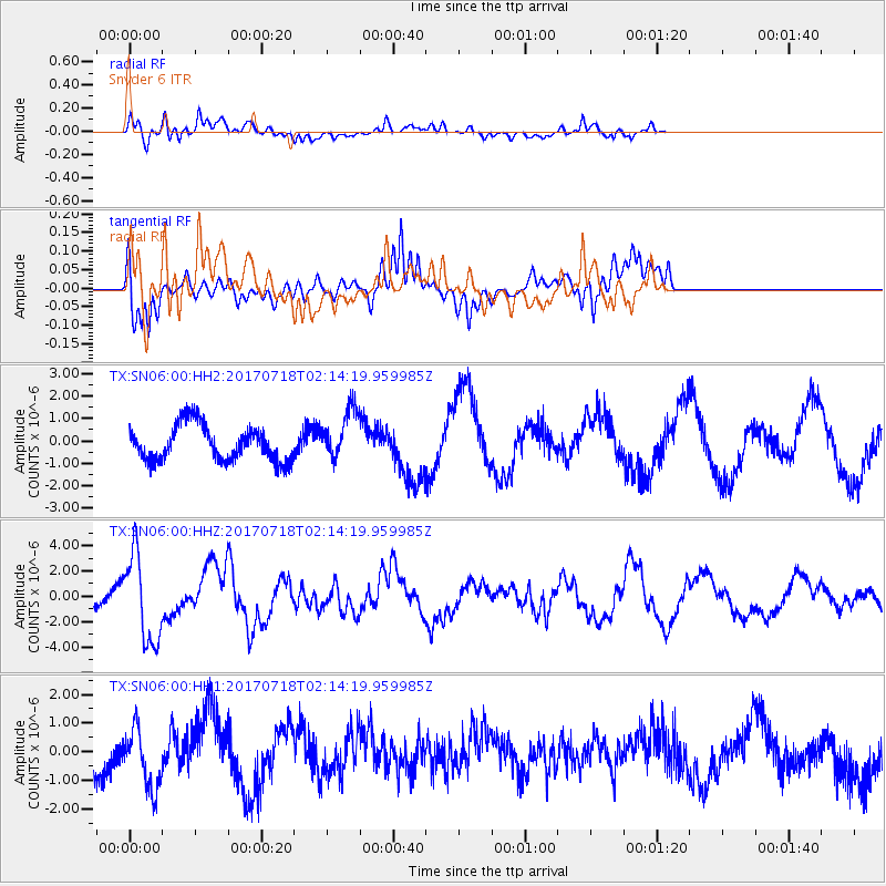
SN06 Snyder 6 - Earthquake Result Viewer
*The percent match for this event was below the threshold and hence no stack was calculated.
| Earthquake location: |
Near Coast Of Peru |
| Earthquake latitude/longitude: |
-16.4/-73.6 |
| Earthquake time(UTC): |
2017/07/18 (199) 02:05:19 GMT |
| Earthquake Depth: |
44 km |
| Earthquake Magnitude: |
6.4 Mww |
| Earthquake Catalog/Contributor: |
NEIC PDE/us |
|
| Network: |
TX Texas Seismological Network |
| Station: |
SN06 Snyder 6 |
| Lat/Lon: |
32.88 N/100.93 W |
| Elevation: |
769 m |
|
| Distance: |
55.5 deg |
| Az: |
332.057 deg |
| Baz: |
147.691 deg |
| Ray Param: |
$rayparam |
*The percent match for this event was below the threshold and hence was not used in the summary stack. |
|
| Radial Match: |
31.571308 % |
| Radial Bump: |
400 |
| Transverse Match: |
41.541214 % |
| Transverse Bump: |
400 |
| SOD ConfigId: |
2140511 |
| Insert Time: |
2017-07-31 18:05:38.073 +0000 |
| GWidth: |
2.5 |
| Max Bumps: |
400 |
| Tol: |
0.001 |
|
Signal To Noise
| Channel | StoN | STA | LTA |
| TX:SN06:00:HHZ:20170718T02:14:19.959985Z | 8.55255 | 3.4645711E-6 | 4.0509215E-7 |
| TX:SN06:00:HH1:20170718T02:14:19.959985Z | 1.1732434 | 1.0533373E-6 | 8.977995E-7 |
| TX:SN06:00:HH2:20170718T02:14:19.959985Z | 1.4008117 | 1.1064445E-6 | 7.898596E-7 |
| Arrivals |
| Ps | |
| PpPs | |
| PsPs/PpSs | |


