You are here: Home > Network List > UU - University of Utah Regional Network Stations List
> Station PSUT Pine Spring, UT, USA > Earthquake Result Viewer
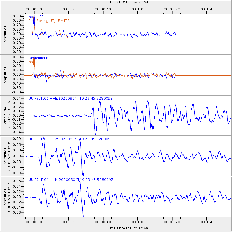
PSUT Pine Spring, UT, USA - Earthquake Result Viewer

| Earthquake location: |
Near Coast Of Guatemala |
| Earthquake latitude/longitude: |
13.4/-92.0 |
| Earthquake time(UTC): |
2020/08/04 (217) 19:17:52 GMT |
| Earthquake Depth: |
12 km |
| Earthquake Magnitude: |
5.8 mww |
| Earthquake Catalog/Contributor: |
NEIC PDE/us |
|
| Network: |
UU University of Utah Regional Network |
| Station: |
PSUT Pine Spring, UT, USA |
| Lat/Lon: |
38.53 N/113.85 W |
| Elevation: |
1999 m |
|
| Distance: |
31.7 deg |
| Az: |
326.191 deg |
| Baz: |
136.327 deg |
| Ray Param: |
0.078963876 |
| Estimated Moho Depth: |
38.5 km |
| Estimated Crust Vp/Vs: |
2.00 |
| Assumed Crust Vp: |
6.276 km/s |
| Estimated Crust Vs: |
3.138 km/s |
| Estimated Crust Poisson's Ratio: |
0.33 |
|
| Radial Match: |
91.48239 % |
| Radial Bump: |
400 |
| Transverse Match: |
85.94895 % |
| Transverse Bump: |
400 |
| SOD ConfigId: |
21709731 |
| Insert Time: |
2020-08-18 19:44:44.957 +0000 |
| GWidth: |
2.5 |
| Max Bumps: |
400 |
| Tol: |
0.001 |
|
Signal To Noise
| Channel | StoN | STA | LTA |
| UU:PSUT:01:HHZ:20200804T19:23:45.528009Z | 9.485087 | 1.9157175E-8 | 2.019715E-9 |
| UU:PSUT:01:HHN:20200804T19:23:45.528009Z | 7.40513 | 9.256044E-9 | 1.2499503E-9 |
| UU:PSUT:01:HHE:20200804T19:23:45.528009Z | 5.901354 | 7.944821E-9 | 1.346271E-9 |
| Arrivals |
| Ps | 6.6 SECOND |
| PpPs | 17 SECOND |
| PsPs/PpSs | 24 SECOND |


