Y07 Y07 - Earthquake Result Viewer
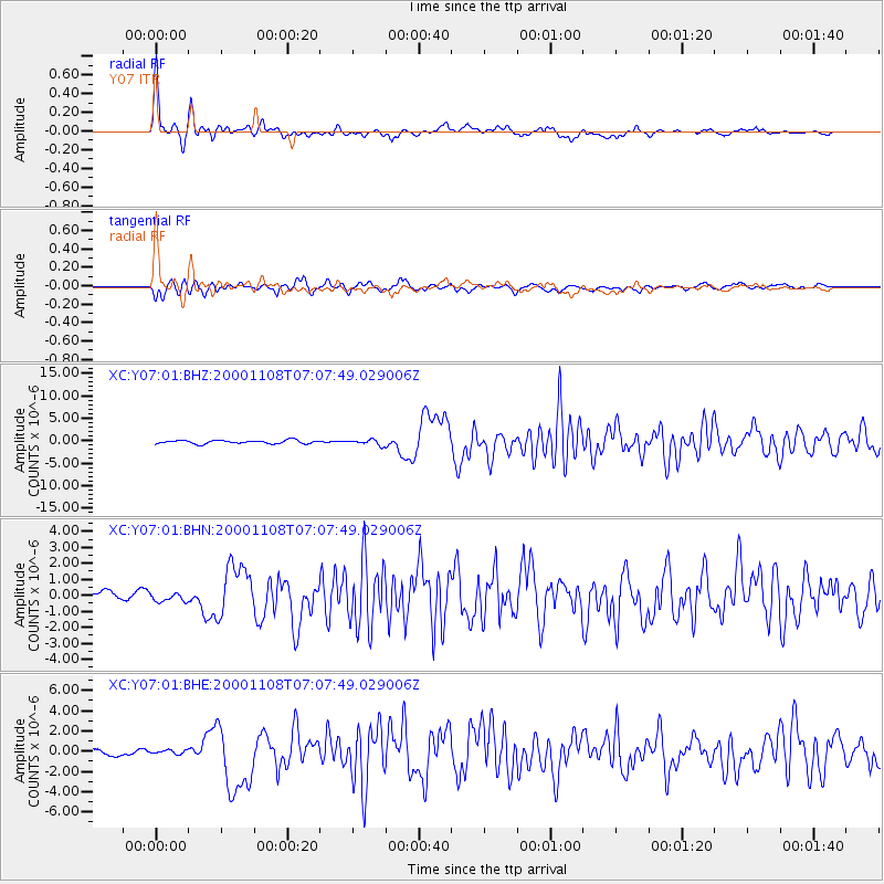
Earthquake location: Panama-Colombia Border Region
Earthquake latitude/longitude: 7.0/-77.8
Earthquake time(UTC): 2000/11/08 (313) 06:59:58 GMT
Earthquake Depth: 17 km
Earthquake Magnitude: 6.0 MB, 6.4 MS, 6.5 MW, 6.2 ML
Earthquake Catalog/Contributor: WHDF/NEIC
Network: XC Yellowstone Intermountain Seismic Array
Station: Y07 Y07
Lat/Lon: 42.56 N/110.89 W
Elevation: 2155 m
Distance: 45.8 deg
Az: 325.819 deg
Baz: 130.998 deg
Ray Param: 0.0709993
Estimated Moho Depth: 37.5 km
Estimated Crust Vp/Vs: 1.86
Assumed Crust Vp: 6.207 km/s
Estimated Crust Vs: 3.341 km/s
Estimated Crust Poisson's Ratio: 0.30
Radial Match: 92.06147 %
Radial Bump: 394
Transverse Match: 81.57504 %
Transverse Bump: 400
SOD ConfigId: 3744
Insert Time: 2010-02-26 15:00:46.898 +0000
GWidth: 2.5
Max Bumps: 400
Tol: 0.001

Signal To Noise

ChannelStoNSTALTA
XC:Y07:01:BHN:20001108T07:07:49.029006Z0.883875973.1079668E-73.516293E-7
XC:Y07:01:BHE:20001108T07:07:49.029006Z0.40721581.9627865E-74.8200155E-7
XC:Y07:01:BHZ:20001108T07:07:49.029006Z1.60775715.9689665E-73.7126046E-7
Arrivals
Ps5.5 SECOND
PpPs16 SECOND
PsPs/PpSs22 SECOND