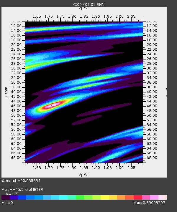
Y07 Y07 - Earthquake Result Viewer

Earthquake location: Near Coast Of Ecuador
Earthquake latitude/longitude: -0.2/-80.6
Earthquake time(UTC): 2000/09/28 (272) 23:23:43 GMT
Earthquake Depth: 23 km
Earthquake Magnitude: 5.8 MB, 6.0 MS, 6.6 MW, 6.4 MW
Earthquake Catalog/Contributor: WHDF/NEIC
Network: XC Yellowstone Intermountain Seismic Array
Station: Y07 Y07
Lat/Lon: 42.56 N/110.89 W
Elevation: 2155 m
Distance: 50.6 deg
Az: 331.133 deg
Baz: 139.2 deg
Ray Param: 0.06794532
Estimated Moho Depth: 45.5 km
Estimated Crust Vp/Vs: 1.71
Assumed Crust Vp: 6.207 km/s
Estimated Crust Vs: 3.63 km/s
Estimated Crust Poisson's Ratio: 0.24
Radial Match: 90.935684 %
Radial Bump: 274
Transverse Match: 83.84458 %
Transverse Bump: 400
SOD ConfigId: 3744
Insert Time: 2010-02-26 15:00:47.879 +0000
GWidth: 2.5
Max Bumps: 400
Tol: 0.001

Signal To Noise

ChannelStoNSTALTA
XC:Y07:01:BHN:20000928T23:32:09.128015Z0.80609942.1582939E-72.6774538E-7
XC:Y07:01:BHE:20000928T23:32:09.128015Z1.37491563.860703E-72.8079566E-7
XC:Y07:01:BHZ:20000928T23:32:09.128015Z1.4075893.3067496E-72.3492295E-7
Arrivals
Ps5.5 SECOND
PpPs19 SECOND
PsPs/PpSs24 SECOND