
Y07 Y07 - Earthquake Result Viewer
| ||||||||||||||||||
| ||||||||||||||||||
| ||||||||||||||||||
|
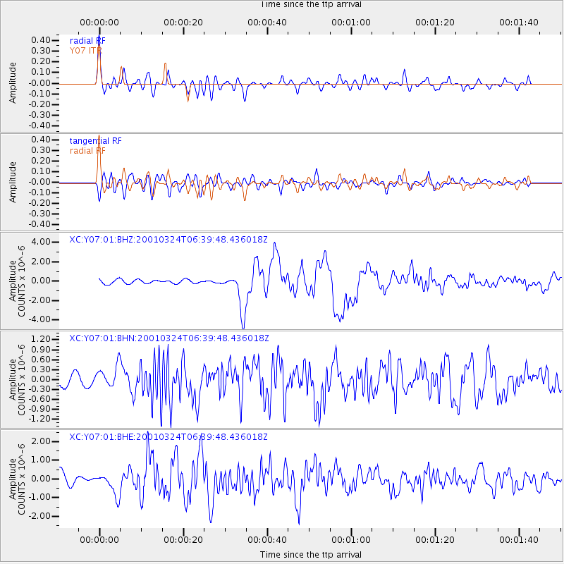
Signal To Noise
| Channel | StoN | STA | LTA |
| XC:Y07:01:BHN:20010324T06:39:48.436018Z | 2.4514952 | 3.9112246E-7 | 1.5954446E-7 |
| XC:Y07:01:BHE:20010324T06:39:48.436018Z | 2.2189882 | 6.2407844E-7 | 2.812446E-7 |
| XC:Y07:01:BHZ:20010324T06:39:48.436018Z | 9.869122 | 2.0129091E-6 | 2.0396031E-7 |
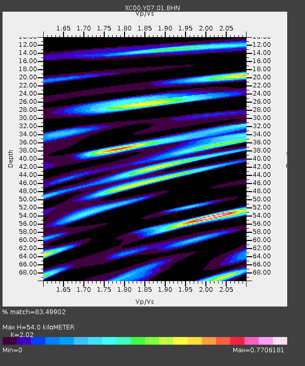
| Arrivals | |
| Ps | 9.1 SECOND |
| PpPs | 26 SECOND |
| PsPs/PpSs | 35 SECOND |

