
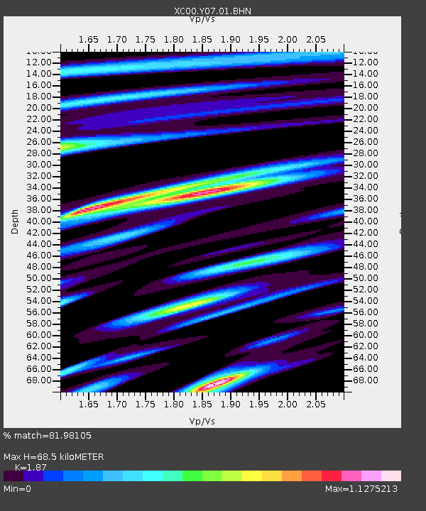
Y07 Y07 - Earthquake Result Viewer
| ||||||||||||||||||
| ||||||||||||||||||
| ||||||||||||||||||
|
Signal To Noise
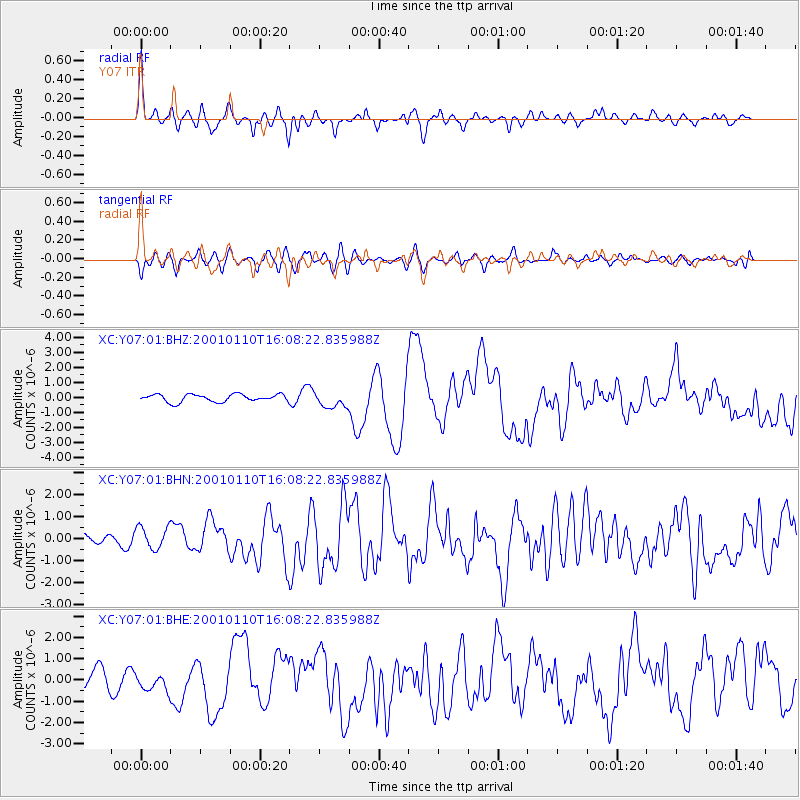
| Channel | StoN | STA | LTA |
| XC:Y07:01:BHN:20010110T16:08:22.835988Z | 1.7480091 | 5.1430584E-7 | 2.9422378E-7 |
| XC:Y07:01:BHE:20010110T16:08:22.835988Z | 0.82588285 | 3.8222595E-7 | 4.628089E-7 |
| XC:Y07:01:BHZ:20010110T16:08:22.835988Z | 2.1435401 | 5.3362385E-7 | 2.4894513E-7 |
| Arrivals | |
| Ps | 10 SECOND |
| PpPs | 30 SECOND |
| PsPs/PpSs | 40 SECOND |

