Y07 Y07 - Earthquake Result Viewer
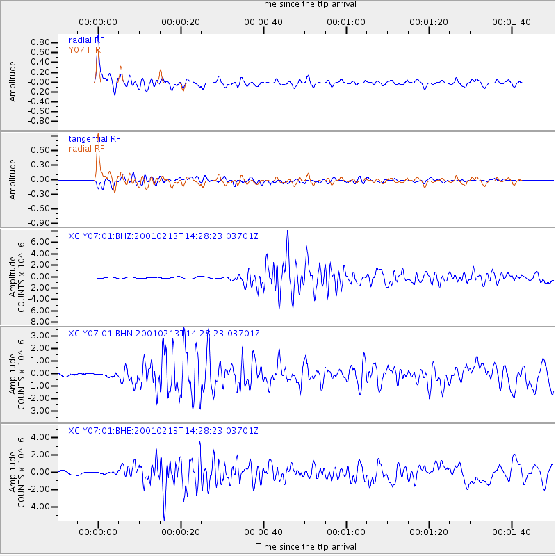
Earthquake location: El Salvador
Earthquake latitude/longitude: 13.7/-88.9
Earthquake time(UTC): 2001/02/13 (044) 14:22:05 GMT
Earthquake Depth: 10 km
Earthquake Magnitude: 5.5 MB, 6.5 MS, 6.6 MW, 6.1 MD
Earthquake Catalog/Contributor: WHDF/NEIC
Network: XC Yellowstone Intermountain Seismic Array
Station: Y07 Y07
Lat/Lon: 42.56 N/110.89 W
Elevation: 2155 m
Distance: 34.5 deg
Az: 330.799 deg
Baz: 140.07 deg
Ray Param: 0.07772346
Estimated Moho Depth: 17.75 km
Estimated Crust Vp/Vs: 1.85
Assumed Crust Vp: 6.207 km/s
Estimated Crust Vs: 3.35 km/s
Estimated Crust Poisson's Ratio: 0.29
Radial Match: 88.999596 %
Radial Bump: 400
Transverse Match: 82.70395 %
Transverse Bump: 400
SOD ConfigId: 3744
Insert Time: 2010-02-26 15:00:56.014 +0000
GWidth: 2.5
Max Bumps: 400
Tol: 0.001

Signal To Noise

ChannelStoNSTALTA
XC:Y07:01:BHN:20010213T14:28:23.03701Z0.79415891.1572942E-71.4572578E-7
XC:Y07:01:BHE:20010213T14:28:23.03701Z0.796202541.7597918E-72.2102314E-7
XC:Y07:01:BHZ:20010213T14:28:23.03701Z2.27064972.8562047E-71.25788E-7
Arrivals
Ps2.6 SECOND
PpPs7.6 SECOND
PsPs/PpSs10 SECOND