You are here: Home > Network List > US - United States National Seismic Network Stations List
> Station MNTX Cornudas Mountains, Texas, USA > Earthquake Result Viewer
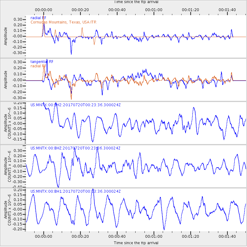
MNTX Cornudas Mountains, Texas, USA - Earthquake Result Viewer
*The percent match for this event was below the threshold and hence no stack was calculated.
| Earthquake location: |
Near East Coast Of Honshu, Japan |
| Earthquake latitude/longitude: |
37.4/141.6 |
| Earthquake time(UTC): |
2017/07/20 (201) 00:11:25 GMT |
| Earthquake Depth: |
35 km |
| Earthquake Magnitude: |
5.8 Mww |
| Earthquake Catalog/Contributor: |
NEIC PDE/us |
|
| Network: |
US United States National Seismic Network |
| Station: |
MNTX Cornudas Mountains, Texas, USA |
| Lat/Lon: |
31.70 N/105.38 W |
| Elevation: |
404 m |
|
| Distance: |
87.1 deg |
| Az: |
51.768 deg |
| Baz: |
312.807 deg |
| Ray Param: |
$rayparam |
*The percent match for this event was below the threshold and hence was not used in the summary stack. |
|
| Radial Match: |
72.23857 % |
| Radial Bump: |
400 |
| Transverse Match: |
65.72588 % |
| Transverse Bump: |
400 |
| SOD ConfigId: |
2140511 |
| Insert Time: |
2017-08-02 16:07:53.201 +0000 |
| GWidth: |
2.5 |
| Max Bumps: |
400 |
| Tol: |
0.001 |
|
Signal To Noise
| Channel | StoN | STA | LTA |
| US:MNTX:00:BHZ:20170720T00:23:36.300024Z | 1.0463442 | 1.0034253E-7 | 9.589821E-8 |
| US:MNTX:00:BH1:20170720T00:23:36.300024Z | 0.51991034 | 4.3384784E-8 | 8.3446665E-8 |
| US:MNTX:00:BH2:20170720T00:23:36.300024Z | 0.90655345 | 7.212053E-8 | 7.955463E-8 |
| Arrivals |
| Ps | |
| PpPs | |
| PsPs/PpSs | |


