You are here: Home > Network List > CI - Caltech Regional Seismic Network Stations List
> Station MPM Manuel Prospect Mine, California, USA > Earthquake Result Viewer
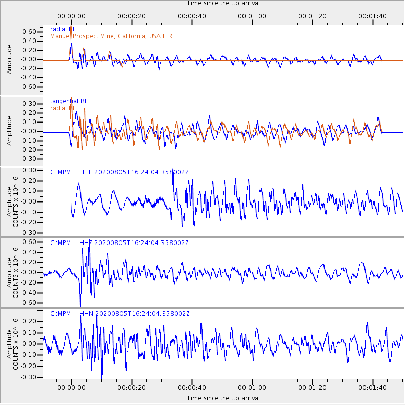
MPM Manuel Prospect Mine, California, USA - Earthquake Result Viewer
*The percent match for this event was below the threshold and hence no stack was calculated.
| Earthquake location: |
Alaska Peninsula |
| Earthquake latitude/longitude: |
54.6/-161.2 |
| Earthquake time(UTC): |
2020/08/05 (218) 16:17:40 GMT |
| Earthquake Depth: |
4.8 km |
| Earthquake Magnitude: |
5.2 Mww |
| Earthquake Catalog/Contributor: |
NEIC PDE/us |
|
| Network: |
CI Caltech Regional Seismic Network |
| Station: |
MPM Manuel Prospect Mine, California, USA |
| Lat/Lon: |
36.06 N/117.49 W |
| Elevation: |
185 m |
|
| Distance: |
35.2 deg |
| Az: |
103.59 deg |
| Baz: |
315.734 deg |
| Ray Param: |
$rayparam |
*The percent match for this event was below the threshold and hence was not used in the summary stack. |
|
| Radial Match: |
70.81308 % |
| Radial Bump: |
400 |
| Transverse Match: |
53.164387 % |
| Transverse Bump: |
400 |
| SOD ConfigId: |
21709731 |
| Insert Time: |
2020-08-19 16:20:55.704 +0000 |
| GWidth: |
2.5 |
| Max Bumps: |
400 |
| Tol: |
0.001 |
|
Signal To Noise
| Channel | StoN | STA | LTA |
| CI:MPM: :HHZ:20200805T16:24:04.358002Z | 6.877709 | 2.0731346E-7 | 3.0142807E-8 |
| CI:MPM: :HHN:20200805T16:24:04.358002Z | 1.4688997 | 8.8328854E-8 | 6.013266E-8 |
| CI:MPM: :HHE:20200805T16:24:04.358002Z | 1.5365362 | 9.764207E-8 | 6.354687E-8 |
| Arrivals |
| Ps | |
| PpPs | |
| PsPs/PpSs | |


