You are here: Home > Network List > CI - Caltech Regional Seismic Network Stations List
> Station SMM Simmler, CA, USA > Earthquake Result Viewer
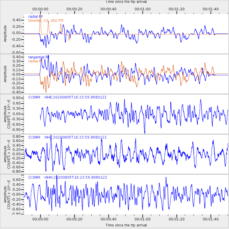
SMM Simmler, CA, USA - Earthquake Result Viewer
*The percent match for this event was below the threshold and hence no stack was calculated.
| Earthquake location: |
Alaska Peninsula |
| Earthquake latitude/longitude: |
54.6/-161.2 |
| Earthquake time(UTC): |
2020/08/05 (218) 16:17:40 GMT |
| Earthquake Depth: |
4.8 km |
| Earthquake Magnitude: |
5.2 Mww |
| Earthquake Catalog/Contributor: |
NEIC PDE/us |
|
| Network: |
CI Caltech Regional Seismic Network |
| Station: |
SMM Simmler, CA, USA |
| Lat/Lon: |
35.31 N/120.00 W |
| Elevation: |
599 m |
|
| Distance: |
34.3 deg |
| Az: |
107.083 deg |
| Baz: |
317.149 deg |
| Ray Param: |
$rayparam |
*The percent match for this event was below the threshold and hence was not used in the summary stack. |
|
| Radial Match: |
48.50331 % |
| Radial Bump: |
400 |
| Transverse Match: |
47.975857 % |
| Transverse Bump: |
400 |
| SOD ConfigId: |
21709731 |
| Insert Time: |
2020-08-19 16:21:15.811 +0000 |
| GWidth: |
2.5 |
| Max Bumps: |
400 |
| Tol: |
0.001 |
|
Signal To Noise
| Channel | StoN | STA | LTA |
| CI:SMM: :HHZ:20200805T16:23:56.868012Z | 2.1018343 | 3.0283078E-7 | 1.4407928E-7 |
| CI:SMM: :HHN:20200805T16:23:56.868012Z | 1.1937819 | 2.4842234E-7 | 2.0809694E-7 |
| CI:SMM: :HHE:20200805T16:23:56.868012Z | 1.1205884 | 2.2861076E-7 | 2.0400957E-7 |
| Arrivals |
| Ps | |
| PpPs | |
| PsPs/PpSs | |


