You are here: Home > Network List > US - United States National Seismic Network Stations List
> Station MSO Missoula, Montana, USA > Earthquake Result Viewer
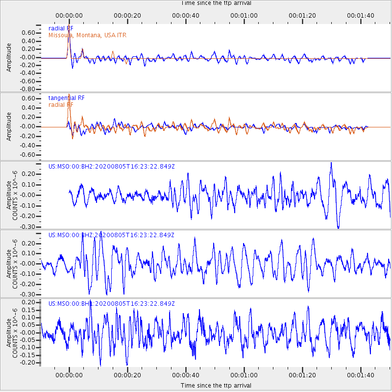
MSO Missoula, Montana, USA - Earthquake Result Viewer
*The percent match for this event was below the threshold and hence no stack was calculated.
| Earthquake location: |
Alaska Peninsula |
| Earthquake latitude/longitude: |
54.6/-161.2 |
| Earthquake time(UTC): |
2020/08/05 (218) 16:17:40 GMT |
| Earthquake Depth: |
4.8 km |
| Earthquake Magnitude: |
5.2 Mww |
| Earthquake Catalog/Contributor: |
NEIC PDE/us |
|
| Network: |
US United States National Seismic Network |
| Station: |
MSO Missoula, Montana, USA |
| Lat/Lon: |
46.83 N/113.94 W |
| Elevation: |
1264 m |
|
| Distance: |
30.4 deg |
| Az: |
85.008 deg |
| Baz: |
302.41 deg |
| Ray Param: |
$rayparam |
*The percent match for this event was below the threshold and hence was not used in the summary stack. |
|
| Radial Match: |
69.79657 % |
| Radial Bump: |
400 |
| Transverse Match: |
54.90887 % |
| Transverse Bump: |
400 |
| SOD ConfigId: |
21709731 |
| Insert Time: |
2020-08-19 16:36:49.092 +0000 |
| GWidth: |
2.5 |
| Max Bumps: |
400 |
| Tol: |
0.001 |
|
Signal To Noise
| Channel | StoN | STA | LTA |
| US:MSO:00:BHZ:20200805T16:23:22.849Z | 2.6808987 | 1.0735543E-7 | 4.004457E-8 |
| US:MSO:00:BH1:20200805T16:23:22.849Z | 1.2569766 | 5.727446E-8 | 4.5565255E-8 |
| US:MSO:00:BH2:20200805T16:23:22.849Z | 0.92975205 | 4.186554E-8 | 4.5028717E-8 |
| Arrivals |
| Ps | |
| PpPs | |
| PsPs/PpSs | |


