You are here: Home > Network List > US - United States National Seismic Network Stations List
> Station WUAZ Wupatki, Arizona, USA > Earthquake Result Viewer
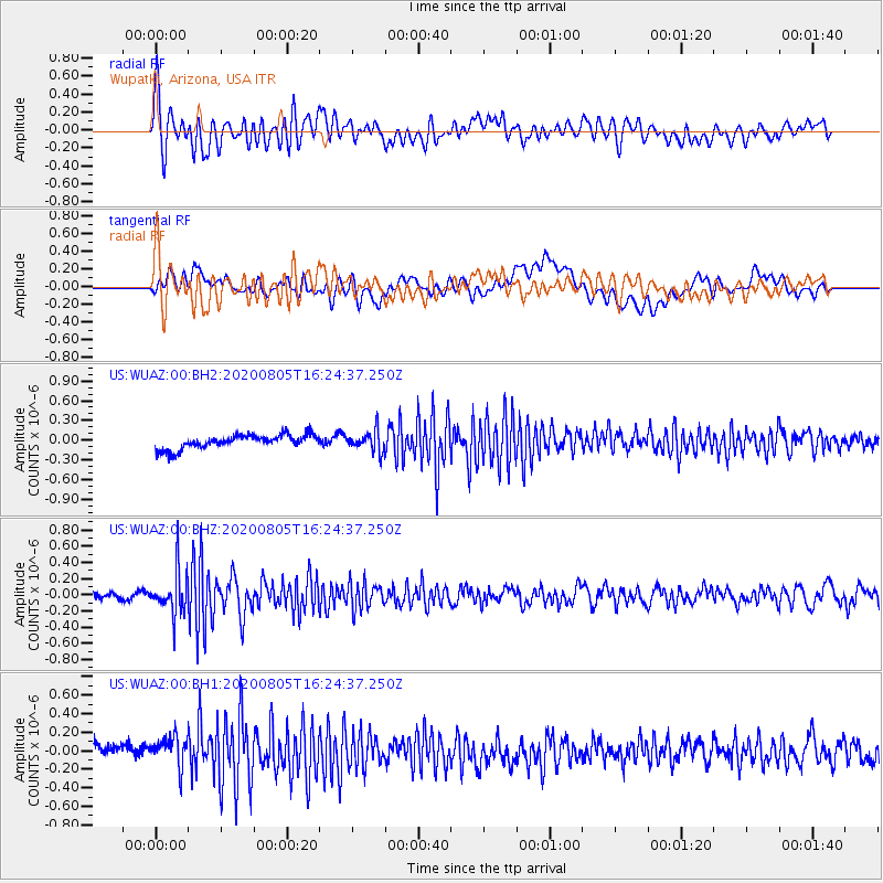
WUAZ Wupatki, Arizona, USA - Earthquake Result Viewer
*The percent match for this event was below the threshold and hence no stack was calculated.
| Earthquake location: |
Alaska Peninsula |
| Earthquake latitude/longitude: |
54.6/-161.2 |
| Earthquake time(UTC): |
2020/08/05 (218) 16:17:40 GMT |
| Earthquake Depth: |
4.8 km |
| Earthquake Magnitude: |
5.2 Mww |
| Earthquake Catalog/Contributor: |
NEIC PDE/us |
|
| Network: |
US United States National Seismic Network |
| Station: |
WUAZ Wupatki, Arizona, USA |
| Lat/Lon: |
35.52 N/111.37 W |
| Elevation: |
1592 m |
|
| Distance: |
39.1 deg |
| Az: |
98.349 deg |
| Baz: |
315.113 deg |
| Ray Param: |
$rayparam |
*The percent match for this event was below the threshold and hence was not used in the summary stack. |
|
| Radial Match: |
71.27439 % |
| Radial Bump: |
400 |
| Transverse Match: |
42.726105 % |
| Transverse Bump: |
400 |
| SOD ConfigId: |
21709731 |
| Insert Time: |
2020-08-19 16:36:58.748 +0000 |
| GWidth: |
2.5 |
| Max Bumps: |
400 |
| Tol: |
0.001 |
|
Signal To Noise
| Channel | StoN | STA | LTA |
| US:WUAZ:00:BHZ:20200805T16:24:37.250Z | 5.2741003 | 2.692011E-7 | 5.104209E-8 |
| US:WUAZ:00:BH1:20200805T16:24:37.250Z | 1.6839762 | 1.7949495E-7 | 1.0658996E-7 |
| US:WUAZ:00:BH2:20200805T16:24:37.250Z | 1.4157826 | 1.5241991E-7 | 1.0765772E-7 |
| Arrivals |
| Ps | |
| PpPs | |
| PsPs/PpSs | |


