You are here: Home > Network List > CI - Caltech Regional Seismic Network Stations List
> Station MPM Manuel Prospect Mine, California, USA > Earthquake Result Viewer
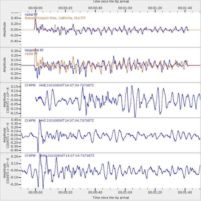
MPM Manuel Prospect Mine, California, USA - Earthquake Result Viewer
*The percent match for this event was below the threshold and hence no stack was calculated.
| Earthquake location: |
Easter Island Region |
| Earthquake latitude/longitude: |
-22.8/-112.3 |
| Earthquake time(UTC): |
2020/08/06 (219) 13:57:38 GMT |
| Earthquake Depth: |
10 km |
| Earthquake Magnitude: |
5.5 mb |
| Earthquake Catalog/Contributor: |
NEIC PDE/us |
|
| Network: |
CI Caltech Regional Seismic Network |
| Station: |
MPM Manuel Prospect Mine, California, USA |
| Lat/Lon: |
36.06 N/117.49 W |
| Elevation: |
185 m |
|
| Distance: |
58.7 deg |
| Az: |
355.118 deg |
| Baz: |
174.437 deg |
| Ray Param: |
$rayparam |
*The percent match for this event was below the threshold and hence was not used in the summary stack. |
|
| Radial Match: |
61.191513 % |
| Radial Bump: |
400 |
| Transverse Match: |
51.48277 % |
| Transverse Bump: |
400 |
| SOD ConfigId: |
21709731 |
| Insert Time: |
2020-08-20 14:05:28.425 +0000 |
| GWidth: |
2.5 |
| Max Bumps: |
400 |
| Tol: |
0.001 |
|
Signal To Noise
| Channel | StoN | STA | LTA |
| CI:MPM: :HHZ:20200806T14:07:04.797987Z | 3.236574 | 2.0044979E-7 | 6.193271E-8 |
| CI:MPM: :HHN:20200806T14:07:04.797987Z | 2.8535202 | 1.15958365E-7 | 4.0636955E-8 |
| CI:MPM: :HHE:20200806T14:07:04.797987Z | 1.8570068 | 8.4411944E-8 | 4.5455916E-8 |
| Arrivals |
| Ps | |
| PpPs | |
| PsPs/PpSs | |


