You are here: Home > Network List > G - GEOSCOPE Stations List
> Station MPG Montagne des Peres, French Guyana > Earthquake Result Viewer
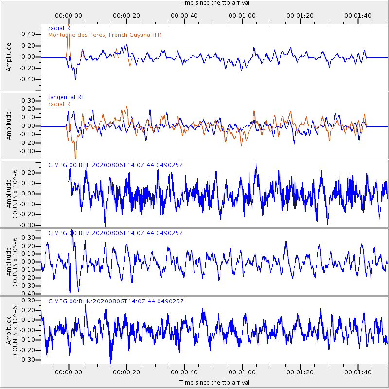
MPG Montagne des Peres, French Guyana - Earthquake Result Viewer
*The percent match for this event was below the threshold and hence no stack was calculated.
| Earthquake location: |
Easter Island Region |
| Earthquake latitude/longitude: |
-22.8/-112.3 |
| Earthquake time(UTC): |
2020/08/06 (219) 13:57:38 GMT |
| Earthquake Depth: |
10 km |
| Earthquake Magnitude: |
5.5 mb |
| Earthquake Catalog/Contributor: |
NEIC PDE/us |
|
| Network: |
G GEOSCOPE |
| Station: |
MPG Montagne des Peres, French Guyana |
| Lat/Lon: |
5.11 N/52.64 W |
| Elevation: |
147 m |
|
| Distance: |
64.5 deg |
| Az: |
72.261 deg |
| Baz: |
241.953 deg |
| Ray Param: |
$rayparam |
*The percent match for this event was below the threshold and hence was not used in the summary stack. |
|
| Radial Match: |
52.82413 % |
| Radial Bump: |
400 |
| Transverse Match: |
60.797176 % |
| Transverse Bump: |
400 |
| SOD ConfigId: |
21709731 |
| Insert Time: |
2020-08-20 14:08:44.359 +0000 |
| GWidth: |
2.5 |
| Max Bumps: |
400 |
| Tol: |
0.001 |
|
Signal To Noise
| Channel | StoN | STA | LTA |
| G:MPG:00:BHZ:20200806T14:07:44.049025Z | 2.1936717 | 2.1585471E-7 | 9.839882E-8 |
| G:MPG:00:BHN:20200806T14:07:44.049025Z | 1.0429846 | 8.99676E-8 | 8.625976E-8 |
| G:MPG:00:BHE:20200806T14:07:44.049025Z | 1.0429986 | 1.00630125E-7 | 9.6481564E-8 |
| Arrivals |
| Ps | |
| PpPs | |
| PsPs/PpSs | |


