You are here: Home > Network List > TA - USArray Transportable Network (new EarthScope stations) Stations List
> Station G31M Satah River, YT, CAN > Earthquake Result Viewer
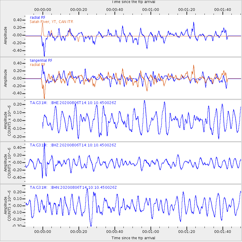
G31M Satah River, YT, CAN - Earthquake Result Viewer
*The percent match for this event was below the threshold and hence no stack was calculated.
| Earthquake location: |
Easter Island Region |
| Earthquake latitude/longitude: |
-22.8/-112.3 |
| Earthquake time(UTC): |
2020/08/06 (219) 13:57:38 GMT |
| Earthquake Depth: |
10 km |
| Earthquake Magnitude: |
5.5 mb |
| Earthquake Catalog/Contributor: |
NEIC PDE/us |
|
| Network: |
TA USArray Transportable Network (new EarthScope stations) |
| Station: |
G31M Satah River, YT, CAN |
| Lat/Lon: |
66.92 N/134.27 W |
| Elevation: |
61 m |
|
| Distance: |
90.9 deg |
| Az: |
351.532 deg |
| Baz: |
159.832 deg |
| Ray Param: |
$rayparam |
*The percent match for this event was below the threshold and hence was not used in the summary stack. |
|
| Radial Match: |
49.96566 % |
| Radial Bump: |
386 |
| Transverse Match: |
51.586155 % |
| Transverse Bump: |
400 |
| SOD ConfigId: |
21709731 |
| Insert Time: |
2020-08-20 14:19:12.924 +0000 |
| GWidth: |
2.5 |
| Max Bumps: |
400 |
| Tol: |
0.001 |
|
Signal To Noise
| Channel | StoN | STA | LTA |
| TA:G31M: :BHZ:20200806T14:10:10.450026Z | 3.8915653 | 2.17686E-7 | 5.59379E-8 |
| TA:G31M: :BHN:20200806T14:10:10.450026Z | 0.70565 | 7.578836E-8 | 1.074022E-7 |
| TA:G31M: :BHE:20200806T14:10:10.450026Z | 1.5628316 | 1.4053778E-7 | 8.9925095E-8 |
| Arrivals |
| Ps | |
| PpPs | |
| PsPs/PpSs | |


