You are here: Home > Network List > TX - Texas Seismological Network Stations List
> Station WTFS Witchita Falls > Earthquake Result Viewer
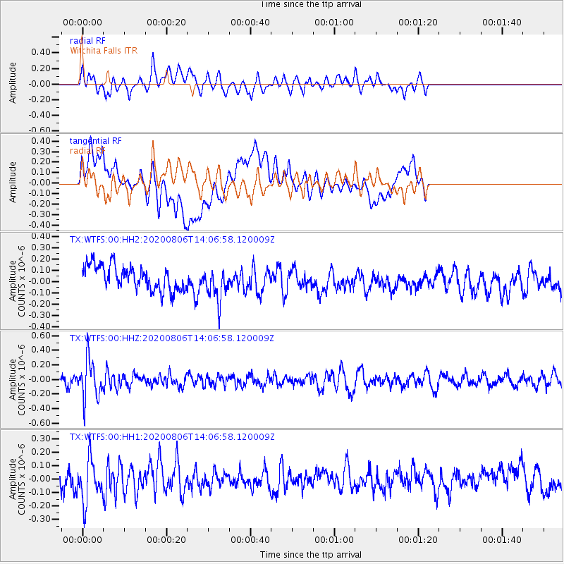
WTFS Witchita Falls - Earthquake Result Viewer
*The percent match for this event was below the threshold and hence no stack was calculated.
| Earthquake location: |
Easter Island Region |
| Earthquake latitude/longitude: |
-22.8/-112.3 |
| Earthquake time(UTC): |
2020/08/06 (219) 13:57:38 GMT |
| Earthquake Depth: |
10 km |
| Earthquake Magnitude: |
5.5 mb |
| Earthquake Catalog/Contributor: |
NEIC PDE/us |
|
| Network: |
TX Texas Seismological Network |
| Station: |
WTFS Witchita Falls |
| Lat/Lon: |
33.77 N/98.46 W |
| Elevation: |
277 m |
|
| Distance: |
57.8 deg |
| Az: |
13.662 deg |
| Baz: |
195.17 deg |
| Ray Param: |
$rayparam |
*The percent match for this event was below the threshold and hence was not used in the summary stack. |
|
| Radial Match: |
53.166985 % |
| Radial Bump: |
400 |
| Transverse Match: |
41.40706 % |
| Transverse Bump: |
400 |
| SOD ConfigId: |
21709731 |
| Insert Time: |
2020-08-20 14:21:37.043 +0000 |
| GWidth: |
2.5 |
| Max Bumps: |
400 |
| Tol: |
0.001 |
|
Signal To Noise
| Channel | StoN | STA | LTA |
| TX:WTFS:00:HHZ:20200806T14:06:58.120009Z | 3.1597507 | 2.7583906E-7 | 8.729773E-8 |
| TX:WTFS:00:HH1:20200806T14:06:58.120009Z | 1.3574111 | 1.623281E-7 | 1.1958653E-7 |
| TX:WTFS:00:HH2:20200806T14:06:58.120009Z | 1.3986651 | 1.4983675E-7 | 1.071284E-7 |
| Arrivals |
| Ps | |
| PpPs | |
| PsPs/PpSs | |


