You are here: Home > Network List > US - United States National Seismic Network Stations List
> Station LAO LASA Array, Montana, USA > Earthquake Result Viewer
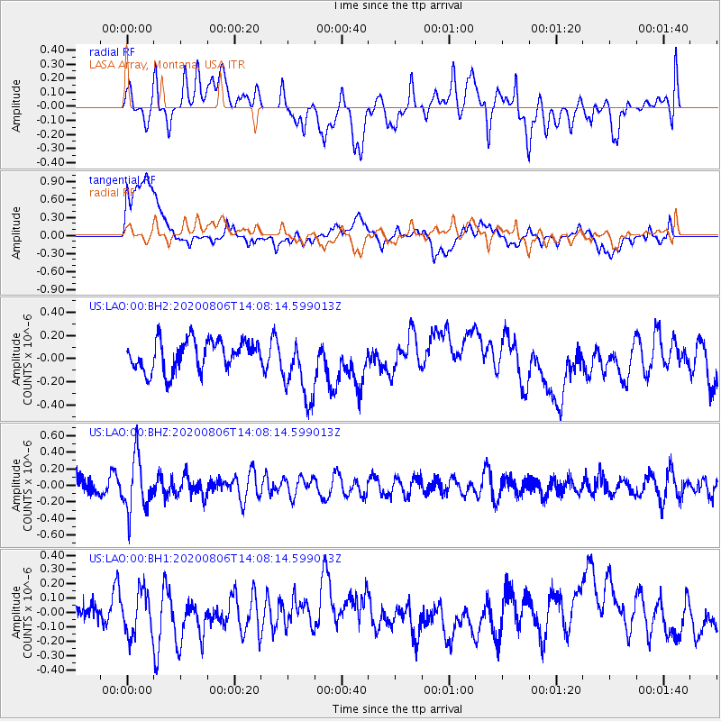
LAO LASA Array, Montana, USA - Earthquake Result Viewer
*The percent match for this event was below the threshold and hence no stack was calculated.
| Earthquake location: |
Easter Island Region |
| Earthquake latitude/longitude: |
-22.8/-112.3 |
| Earthquake time(UTC): |
2020/08/06 (219) 13:57:38 GMT |
| Earthquake Depth: |
10 km |
| Earthquake Magnitude: |
5.5 mb |
| Earthquake Catalog/Contributor: |
NEIC PDE/us |
|
| Network: |
US United States National Seismic Network |
| Station: |
LAO LASA Array, Montana, USA |
| Lat/Lon: |
46.69 N/106.22 W |
| Elevation: |
902 m |
|
| Distance: |
69.4 deg |
| Az: |
4.496 deg |
| Baz: |
186.032 deg |
| Ray Param: |
$rayparam |
*The percent match for this event was below the threshold and hence was not used in the summary stack. |
|
| Radial Match: |
52.103992 % |
| Radial Bump: |
400 |
| Transverse Match: |
34.108143 % |
| Transverse Bump: |
400 |
| SOD ConfigId: |
21709731 |
| Insert Time: |
2020-08-20 14:22:54.610 +0000 |
| GWidth: |
2.5 |
| Max Bumps: |
400 |
| Tol: |
0.001 |
|
Signal To Noise
| Channel | StoN | STA | LTA |
| US:LAO:00:BHZ:20200806T14:08:14.599013Z | 3.1904614 | 3.284894E-7 | 1.02959845E-7 |
| US:LAO:00:BH1:20200806T14:08:14.599013Z | 1.3579168 | 1.5005253E-7 | 1.10502E-7 |
| US:LAO:00:BH2:20200806T14:08:14.599013Z | 2.1934965 | 2.8826372E-7 | 1.3141747E-7 |
| Arrivals |
| Ps | |
| PpPs | |
| PsPs/PpSs | |


