You are here: Home > Network List > US - United States National Seismic Network Stations List
> Station MSO Missoula, Montana, USA > Earthquake Result Viewer
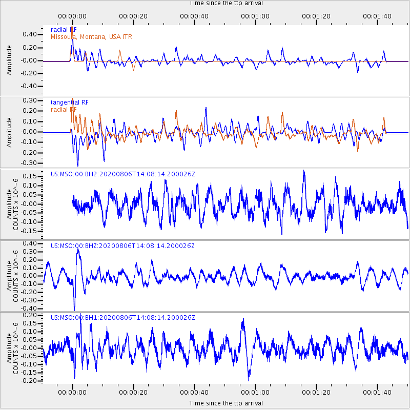
MSO Missoula, Montana, USA - Earthquake Result Viewer
*The percent match for this event was below the threshold and hence no stack was calculated.
| Earthquake location: |
Easter Island Region |
| Earthquake latitude/longitude: |
-22.8/-112.3 |
| Earthquake time(UTC): |
2020/08/06 (219) 13:57:38 GMT |
| Earthquake Depth: |
10 km |
| Earthquake Magnitude: |
5.5 mb |
| Earthquake Catalog/Contributor: |
NEIC PDE/us |
|
| Network: |
US United States National Seismic Network |
| Station: |
MSO Missoula, Montana, USA |
| Lat/Lon: |
46.83 N/113.94 W |
| Elevation: |
1264 m |
|
| Distance: |
69.3 deg |
| Az: |
358.825 deg |
| Baz: |
178.42 deg |
| Ray Param: |
$rayparam |
*The percent match for this event was below the threshold and hence was not used in the summary stack. |
|
| Radial Match: |
61.863182 % |
| Radial Bump: |
400 |
| Transverse Match: |
61.841167 % |
| Transverse Bump: |
400 |
| SOD ConfigId: |
21709731 |
| Insert Time: |
2020-08-20 14:23:03.086 +0000 |
| GWidth: |
2.5 |
| Max Bumps: |
400 |
| Tol: |
0.001 |
|
Signal To Noise
| Channel | StoN | STA | LTA |
| US:MSO:00:BHZ:20200806T14:08:14.200026Z | 2.9009898 | 1.964418E-7 | 6.771545E-8 |
| US:MSO:00:BH1:20200806T14:08:14.200026Z | 1.8954964 | 7.705586E-8 | 4.0652072E-8 |
| US:MSO:00:BH2:20200806T14:08:14.200026Z | 1.6290792 | 7.566161E-8 | 4.6444402E-8 |
| Arrivals |
| Ps | |
| PpPs | |
| PsPs/PpSs | |


