You are here: Home > Network List > CI - Caltech Regional Seismic Network Stations List
> Station MPM Manuel Prospect Mine, California, USA > Earthquake Result Viewer
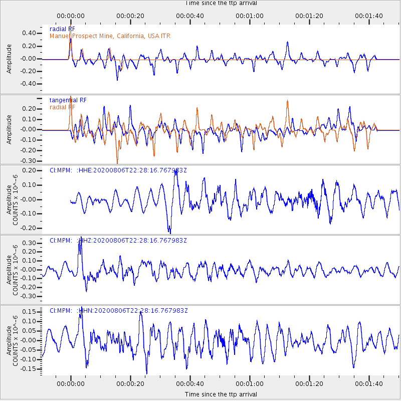
MPM Manuel Prospect Mine, California, USA - Earthquake Result Viewer
*The percent match for this event was below the threshold and hence no stack was calculated.
| Earthquake location: |
Near Coast Of Peru |
| Earthquake latitude/longitude: |
-15.9/-74.9 |
| Earthquake time(UTC): |
2020/08/06 (219) 22:18:04 GMT |
| Earthquake Depth: |
10 km |
| Earthquake Magnitude: |
5.5 Mww |
| Earthquake Catalog/Contributor: |
NEIC PDE/us |
|
| Network: |
CI Caltech Regional Seismic Network |
| Station: |
MPM Manuel Prospect Mine, California, USA |
| Lat/Lon: |
36.06 N/117.49 W |
| Elevation: |
185 m |
|
| Distance: |
65.5 deg |
| Az: |
322.921 deg |
| Baz: |
134.269 deg |
| Ray Param: |
$rayparam |
*The percent match for this event was below the threshold and hence was not used in the summary stack. |
|
| Radial Match: |
52.587753 % |
| Radial Bump: |
362 |
| Transverse Match: |
51.790833 % |
| Transverse Bump: |
400 |
| SOD ConfigId: |
21709731 |
| Insert Time: |
2020-08-20 22:23:38.706 +0000 |
| GWidth: |
2.5 |
| Max Bumps: |
400 |
| Tol: |
0.001 |
|
Signal To Noise
| Channel | StoN | STA | LTA |
| CI:MPM: :HHZ:20200806T22:28:16.767983Z | 3.6846204 | 1.3825587E-7 | 3.752242E-8 |
| CI:MPM: :HHN:20200806T22:28:16.767983Z | 1.6601408 | 7.605848E-8 | 4.581447E-8 |
| CI:MPM: :HHE:20200806T22:28:16.767983Z | 2.7580502 | 1.1546522E-7 | 4.18648E-8 |
| Arrivals |
| Ps | |
| PpPs | |
| PsPs/PpSs | |


