You are here: Home > Network List > US - United States National Seismic Network Stations List
> Station WMOK Wichita Mountains, Oklahoma, USA > Earthquake Result Viewer
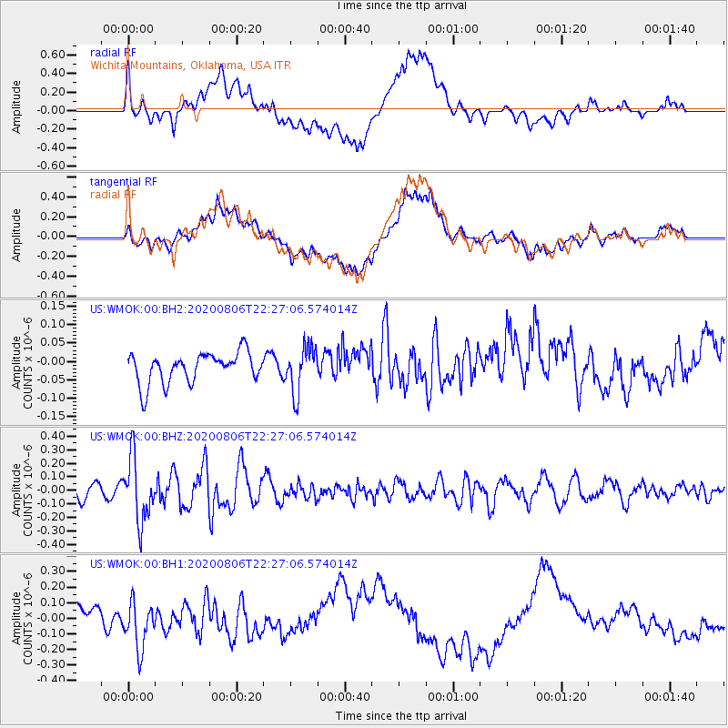
WMOK Wichita Mountains, Oklahoma, USA - Earthquake Result Viewer
*The percent match for this event was below the threshold and hence no stack was calculated.
| Earthquake location: |
Near Coast Of Peru |
| Earthquake latitude/longitude: |
-15.9/-74.9 |
| Earthquake time(UTC): |
2020/08/06 (219) 22:18:04 GMT |
| Earthquake Depth: |
10 km |
| Earthquake Magnitude: |
5.5 Mww |
| Earthquake Catalog/Contributor: |
NEIC PDE/us |
|
| Network: |
US United States National Seismic Network |
| Station: |
WMOK Wichita Mountains, Oklahoma, USA |
| Lat/Lon: |
34.74 N/98.78 W |
| Elevation: |
486 m |
|
| Distance: |
55.2 deg |
| Az: |
336.022 deg |
| Baz: |
151.648 deg |
| Ray Param: |
$rayparam |
*The percent match for this event was below the threshold and hence was not used in the summary stack. |
|
| Radial Match: |
53.028328 % |
| Radial Bump: |
400 |
| Transverse Match: |
49.423447 % |
| Transverse Bump: |
400 |
| SOD ConfigId: |
21709731 |
| Insert Time: |
2020-08-20 22:42:06.726 +0000 |
| GWidth: |
2.5 |
| Max Bumps: |
400 |
| Tol: |
0.001 |
|
Signal To Noise
| Channel | StoN | STA | LTA |
| US:WMOK:00:BHZ:20200806T22:27:06.574014Z | 4.0234222 | 2.387217E-7 | 5.9332994E-8 |
| US:WMOK:00:BH1:20200806T22:27:06.574014Z | 0.9785533 | 1.4039337E-7 | 1.4347033E-7 |
| US:WMOK:00:BH2:20200806T22:27:06.574014Z | 1.529056 | 6.302045E-8 | 4.1215266E-8 |
| Arrivals |
| Ps | |
| PpPs | |
| PsPs/PpSs | |


