You are here: Home > Network List > UU - University of Utah Regional Network Stations List
> Station FORU South Mineral Mountains, UT, USA > Earthquake Result Viewer
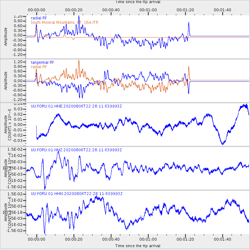
FORU South Mineral Mountains, UT, USA - Earthquake Result Viewer
*The percent match for this event was below the threshold and hence no stack was calculated.
| Earthquake location: |
Near Coast Of Peru |
| Earthquake latitude/longitude: |
-15.9/-74.9 |
| Earthquake time(UTC): |
2020/08/06 (219) 22:18:04 GMT |
| Earthquake Depth: |
10 km |
| Earthquake Magnitude: |
5.5 Mww |
| Earthquake Catalog/Contributor: |
NEIC PDE/us |
|
| Network: |
UU University of Utah Regional Network |
| Station: |
FORU South Mineral Mountains, UT, USA |
| Lat/Lon: |
38.46 N/112.86 W |
| Elevation: |
1840 m |
|
| Distance: |
64.7 deg |
| Az: |
327.693 deg |
| Baz: |
139.07 deg |
| Ray Param: |
$rayparam |
*The percent match for this event was below the threshold and hence was not used in the summary stack. |
|
| Radial Match: |
47.81333 % |
| Radial Bump: |
400 |
| Transverse Match: |
29.563414 % |
| Transverse Bump: |
351 |
| SOD ConfigId: |
21709731 |
| Insert Time: |
2020-08-20 22:42:24.411 +0000 |
| GWidth: |
2.5 |
| Max Bumps: |
400 |
| Tol: |
0.001 |
|
Signal To Noise
| Channel | StoN | STA | LTA |
| UU:FORU:01:HHZ:20200806T22:28:11.639993Z | 3.3393412 | 8.078104E-9 | 2.4190712E-9 |
| UU:FORU:01:HHN:20200806T22:28:11.639993Z | 3.7288358 | 7.751339E-9 | 2.0787556E-9 |
| UU:FORU:01:HHE:20200806T22:28:11.639993Z | 0.2654181 | 3.3414014E-9 | 1.2589199E-8 |
| Arrivals |
| Ps | |
| PpPs | |
| PsPs/PpSs | |


