You are here: Home > Network List > UW - Pacific Northwest Regional Seismic Network Stations List
> Station LEBA Lebam, WA, USA > Earthquake Result Viewer
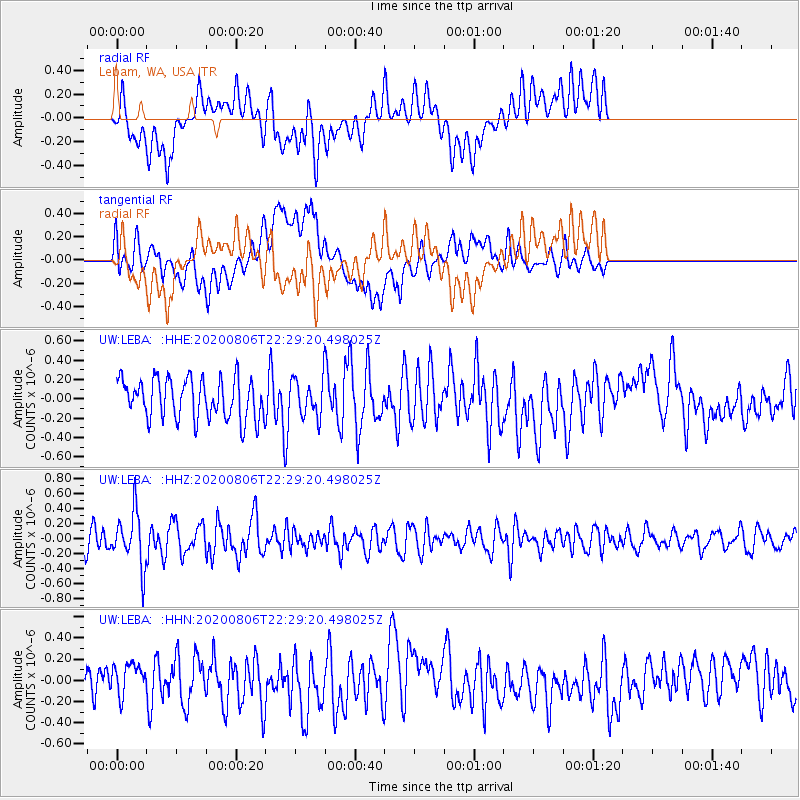
LEBA Lebam, WA, USA - Earthquake Result Viewer
*The percent match for this event was below the threshold and hence no stack was calculated.
| Earthquake location: |
Near Coast Of Peru |
| Earthquake latitude/longitude: |
-15.9/-74.9 |
| Earthquake time(UTC): |
2020/08/06 (219) 22:18:04 GMT |
| Earthquake Depth: |
10 km |
| Earthquake Magnitude: |
5.5 Mww |
| Earthquake Catalog/Contributor: |
NEIC PDE/us |
|
| Network: |
UW Pacific Northwest Regional Seismic Network |
| Station: |
LEBA Lebam, WA, USA |
| Lat/Lon: |
46.55 N/123.56 W |
| Elevation: |
73 m |
|
| Distance: |
76.0 deg |
| Az: |
327.702 deg |
| Baz: |
131.839 deg |
| Ray Param: |
$rayparam |
*The percent match for this event was below the threshold and hence was not used in the summary stack. |
|
| Radial Match: |
59.90698 % |
| Radial Bump: |
400 |
| Transverse Match: |
55.321487 % |
| Transverse Bump: |
400 |
| SOD ConfigId: |
21709731 |
| Insert Time: |
2020-08-20 22:43:31.246 +0000 |
| GWidth: |
2.5 |
| Max Bumps: |
400 |
| Tol: |
0.001 |
|
Signal To Noise
| Channel | StoN | STA | LTA |
| UW:LEBA: :HHZ:20200806T22:29:20.498025Z | 2.44739 | 3.6152704E-7 | 1.4771943E-7 |
| UW:LEBA: :HHN:20200806T22:29:20.498025Z | 0.7231912 | 1.3972101E-7 | 1.9320063E-7 |
| UW:LEBA: :HHE:20200806T22:29:20.498025Z | 0.92122144 | 1.8993599E-7 | 2.0617844E-7 |
| Arrivals |
| Ps | |
| PpPs | |
| PsPs/PpSs | |


